Home Weather Showers And Storms For Florida Today; Tracking The Tropics

Showers And Storms For Florida Today; Tracking The Tropics

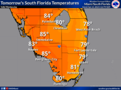
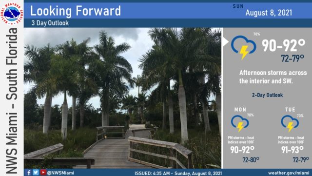
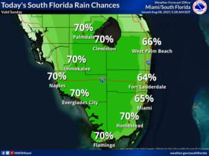
Sunday features good sun to start with periods of showers and storms in the afternoon.  Rain chances are high around South Florida, but the greatest likelihood of strong storms will be in the interior and near the Gulf coast.  Highs on Sunday will be in the sticky low 90s.

LIVE RADAR 24/7 (Click Here Then Press Play)

Monday will bring good sun and a few clouds with periods of showers and storms, mostly in the afternoon.  Monday’s highs will be in the low 90s.

Tuesday will feature plenty of sun but periods of showers as well.  Look for a few storms in spots during the afternoon.  Tuesday’s highs will be in the low 90s.

Wednesday will be a day of good sun, a few clouds, and maybe a shower in the morning, with showers and storms developing in the afternoon.  Wednesday’s highs will be in the low 90s.

Thursday’s forecast calls for a typical August mix of sun, showers, and a few storms.  Highs on Thursday will be in the low 90s again.

In the tropics, the wave in the central Atlantic that we’ve been watching has a low chance of development before it reaches the Lesser Antilles on Monday and the Greater Antilles by midweek.  This wave is then likely to affect portions of the Bahamas and potentially South Florida late in the week or during the weekend.  We’ll keep an eye on it.
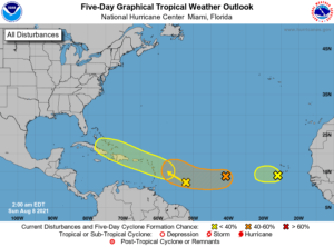
Elsewhere, the area of low pressure in the central Atlantic has a medium chance of developing during the next five days as it moves westward and then west-northwestward.  We’ll keep an eye on it as well.  Finally, the wave about a hundred miles south of the Cape Verde Islands has a low chance of developing as it encounters cooler waters.

Donna Thomas has studied hurricanes for two decades. She holds a PhD in history when her experience with Hurricane Andrew ultimately led her to earn a degree in broadcast meteorology from Mississippi State University. Donna spent 15 years at WFOR-TV (CBS4 in Miami-Fort Lauderdale), where she worked as a weather producer with hurricane experts Bryan Norcross and David Bernard. She also produced hurricane specials and weather-related features and news coverage, as well as serving as pool TV producer at the National Hurricane Center during the 2004 and 2005 seasons. Donna also served as a researcher on NOAA's Atlantic Hurricane Database Reanalysis Project. Donna specializes in Florida's hurricane history.