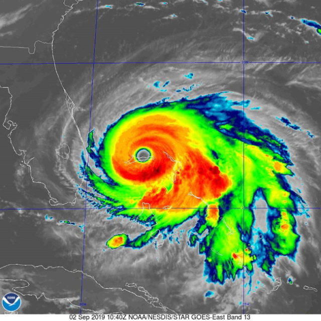
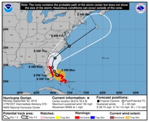
At 2 pm Monday, Dorian was located near 26.8 North, 78.4 West, about 25 miles northeast of Freeport. Maximum sustained winds were 150 miles per hour, but Dorian remains an extremely dangerous category 4 hurricane. Dorian was crawling west-northwest at 1 mile per hour — and we expect a turn more to the north very early Tuesday morning.
In South Florida, watches and warnings remain unchanged from 11 am. There could be modifications after the National Hurricane Center’s 5 pm advisory.
Here in South Florida, we’ll see gusty conditions as Dorian’s outer bands bring in fast-moving showers and storms. Gusts of near-tropical storm force are possible in Miami-Dade and the southern half of Broward County. Northern Broward (especially along the coast) is likely to see fairly strong tropical storm force gusts at times. Palm Beach County can expect sustained tropical storm force winds and possibly stronger gusts at times. Dorian is expected to make its closest approach late Mondayinto the morning hours of Tuesday. Portions of South Florida could see up to 3 inches of rain from Dorian.
Disclaimer
The information contained in South Florida Reporter is for general information purposes only.
The South Florida Reporter assumes no responsibility for errors or omissions in the contents of the Service.
In no event shall the South Florida Reporter be liable for any special, direct, indirect, consequential, or incidental damages or any damages whatsoever, whether in an action of contract, negligence or other tort, arising out of or in connection with the use of the Service or the contents of the Service. The Company reserves the right to make additions, deletions, or modifications to the contents of the Service at any time without prior notice.
The Company does not warrant that the Service is free of viruses or other harmful components