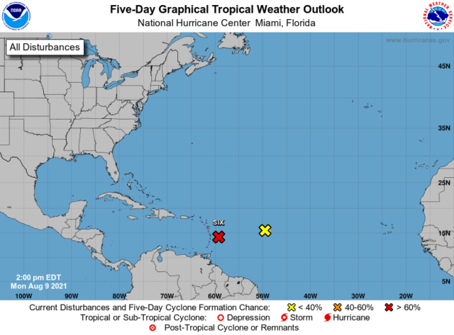
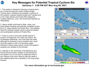
The disturbance in the central Atlantic that we’ve been watching is on the verge of becoming a tropical depression or tropical storm Monday night, so the National Hurricane Center is designating it Potential Tropical Cyclone # 6.
At 5 pm Monday, Potential TC # 6 was located near 14.2 North, 59.2 West, about 165 miles east-southeast of Dominica. Maximum sustained winds were 35 miles per hour, and the system was moving west-northwest at 15 miles per hour.
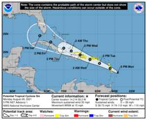
Tropical storm watches are in effect for Dominica, Guadeloupe, Martinique, the U.S. Virgin Islands, Puerto Rico, and most of the coast of the Dominican Republic.
South Florida is currently in the 4-to-5-day “cone,” so we’ll need to watch Potential TC # 6 closely for possible tropical storm impacts late on Friday and on Saturday. Now is a good time to update your hurricane plan — since we’re now in the heart of the hurricane season.
Disclaimer
The information contained in South Florida Reporter is for general information purposes only.
The South Florida Reporter assumes no responsibility for errors or omissions in the contents of the Service.
In no event shall the South Florida Reporter be liable for any special, direct, indirect, consequential, or incidental damages or any damages whatsoever, whether in an action of contract, negligence or other tort, arising out of or in connection with the use of the Service or the contents of the Service. The Company reserves the right to make additions, deletions, or modifications to the contents of the Service at any time without prior notice.
The Company does not warrant that the Service is free of viruses or other harmful components