


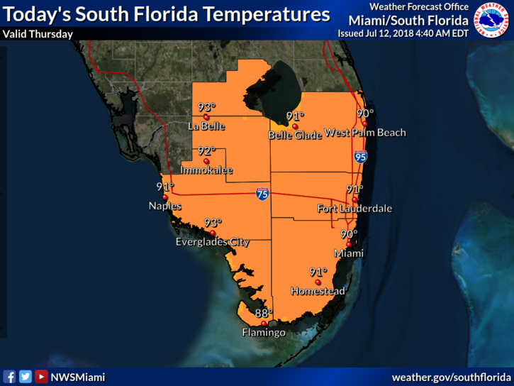
 South Florida will see storms again on Thursday as tropical moisture from what’s left of Beryl drifts into our area. After early sun and clouds, Thursday will see storms and showers form on the sea breezes, starting in the late morning. While most of the activity will be well inland, the metro areas (especially in Miami-Dade) could see some strong storms, with heavy rain, gusty winds, and dangerous lightning. Look for unsettled conditions throughout Thursday afternoon and early evening. Highs on Thursday will be in the low 90s.
Friday will bring sun, clouds, and periods of storms and showers. Again, we could see heavy rain in spots, along with gusty winds and dangerous lightning. Friday’s highs will be in the low 90s — but it will feel like the triple digits.
Saturday will see somewhat drier air begin to filter in, but we’ll also see some afternoon showers and storms. Saturday’s highs will be in the low 90s, but feel quite a bit hotter.
Sunday will be a day of sun, clouds, and spotty showers and storms. Sunday’s highs will be in the sticky low 90s.
Monday’s forecast includes hot sun, some clouds, and a few showers and storms late in the day. Highs on Monday will be in the low 90s.
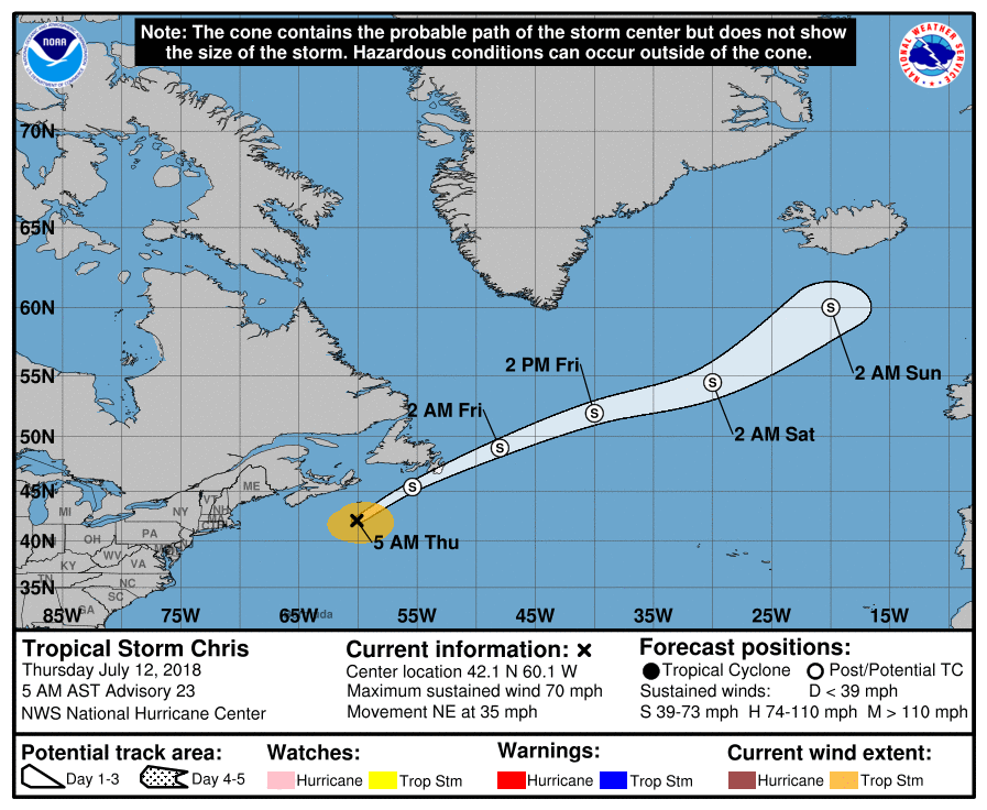 Chris is now a tropical storm and is racing northeastward. At 5 am Thursday, Chris was located near 42.1 North, 60.1 West, or about 245 miles southeast of Halifax, Nova Scotia. Maximum sustained winds were 70 miles per hour, and the storm was zooming northeast at 35 miles per hour. Chris will bring heavy rain to Newfoundland and rough surf to the northeast U.S. coast.
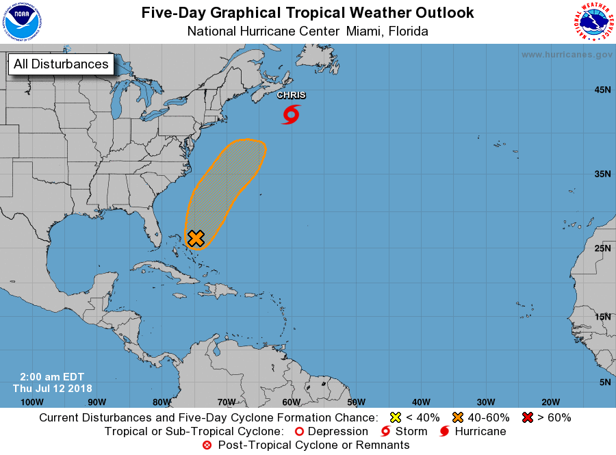 We’re still keeping an eye on the remnants of Beryl, now east of the northwestern Bahamas. There is no sign of redevelopment right now, but the National Hurricane Center gives what’s left of Beryl a medium chance of becoming a tropical storm during the next few days as it moves to the northeast, away from the U.S. coast.


