


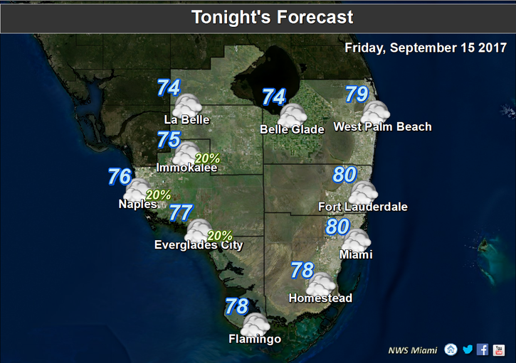
 South Florida is still summery on Friday, and we’re still watching the busy tropics as well.
Here at home, Friday features a mix of sun and clouds, an ocean breeze, and maybe a stray afternoon storm. The strong sea breeze should keep the storms well to our west. Highs on Friday will be near 90 degrees.
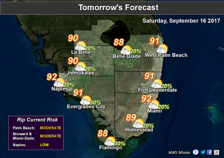 Saturday will bring sun and clouds, with an afternoon storm in spots. Saturday’s highs will be in the low 90s.
Look for more of the same on Sunday — a mix of sun and clouds and a few spotty afternoon storms. Sunday’s highs will be in the low 90s.
Monday features a few early showers at the coast, sun and clouds, and maybe an afternoon storm. Monday’s highs will be near 90 degrees.
The pattern continues on Tuesday, with a few morning showers, sun and clouds, and an afternoon storm in spots. Highs on Tuesday will be near 90 degrees.
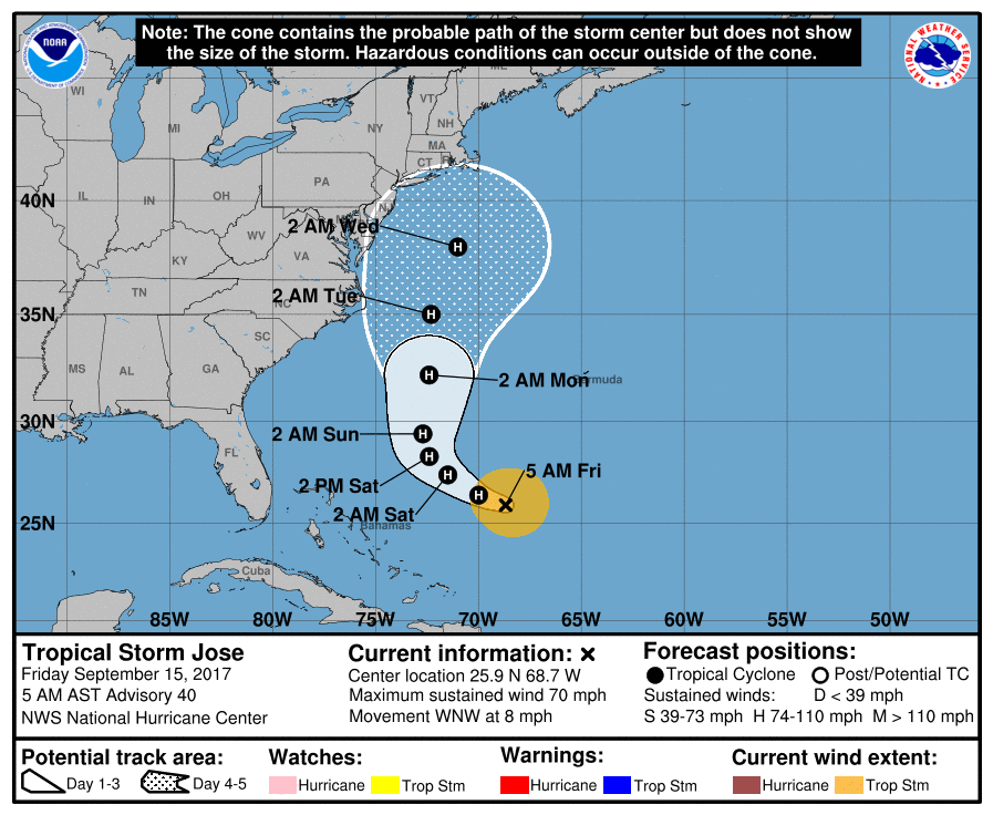 The tropics are busy again. Tropical Storm Jose is on the move and may brush portions of the mid-Atlantic and New England coasts early next week. At 5 am Friday, Jose was located near 25.9 North, 68.7 West, and was moving west-northwest at 8 miles per hour. Maximum sustained winds were 70 miles per hour, but Jose is likely to regain hurricane strength over the weekend.
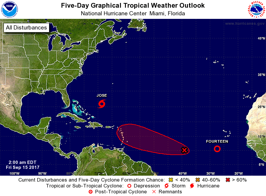 Elsewhere in the tropics, Tropical Depression # 14 has formed in the Atlantic. At 5 am Friday, it was located near 10.6 North, 27.3 West, and was moving west at 15 miles per hour. Maximum sustained winds were 35 miles per hour. And we’ll need to watch an area of disturbed weather in the eastern Atlantic which has a high chance of developing during the next 5 days as it approaches the Lesser Antilles.


