


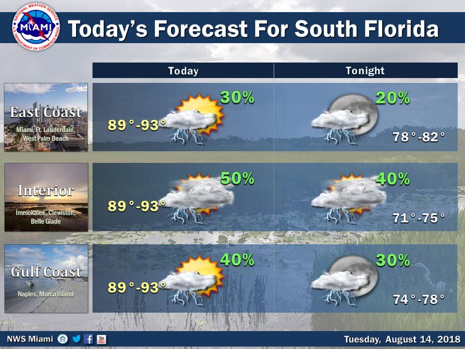
 South Florida will see sun and some storms on Tuesday as more Saharan dust arrives in the afternoon. Tuesday features early sun and clouds, and storms will fire up in spots as the leading edge of the drier air moves into the area. Some storms could be strong, especially in western parts of the area.
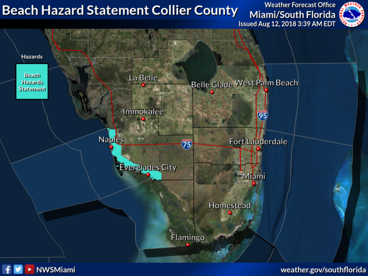 Red tide is again an issue at Gulf coast beaches on Tuesday, at least through Wednesday. Highs on Tuesday will be in the low 90s.
Drier air will be in place on Wednesday, so look for hazy skies and hot sun with just the chance of a storm. Wednesday’s highs will be in the low to mid 90s.
Thursday will be another day of hazy skies and plenty of sun. Thursday’s highs will be in the low to mid 90s.
Friday will feature hot and mostly dry conditions as the dust hangs around. Friday’s highs will be in the low to mid 90s.
Saturday’s forecast includes sun, a few clouds, and an isolated shower or storm in spots. Highs on Saturday will be in the low 90s.
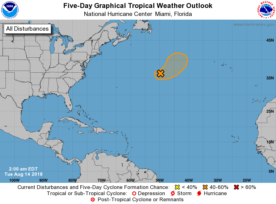 In the tropics, the low that we’ve been watching in the middle of the Atlantic has a medium chance of developing into a tropical or subtropical depression in the next couple of days — at least until it moves into colder waters toward the end of the week.


