Home Weather Isaias Brushes Past South Florida

Isaias Brushes Past South Florida

The center of Tropical Storm Isaias is just off South Florida’s east coast early on Sunday.  We’ll continue to see gusty winds and some downpours from this system during the day as conditions slowly improve from south to north.

LIVE RADAR 24/7 (Click Here Then Press Play)

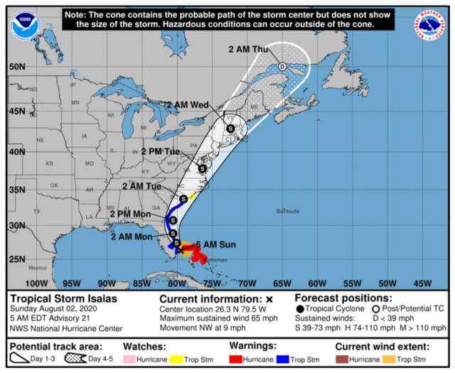
At 5 am Sunday, Isaias was centered near 26.3 North, 79.5 West, about 45 miles southeast of West Palm Beach.  Maximum sustained winds were 65 miles per hour, and Isaias was moving slightly north of northwest at 9 miles per hour.
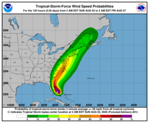
Warnings have changed for South Florida.  There’s a tropical storm warning from Hallandale Beach northward into South Carolina.  The hurricane warning for Florida has been dropped, as has the tropical storm warning for Miami-Dade and non-coastal areas of Broward.

The northwestern Bahamas continues to experience the strongest winds and heaviest rain from Isaias early on Sunday.  A hurricane warning remains in effect for Bimini, Grand Bahama Island, and the Berry Islands.

South Florida might be spared from serious impact, but Isaias isn’t done with the U.S.  It’s forecast to hug the Florida east coast on Sunday and Monday and then make landfall in the Carolinas on Tuesday as a tropical storm.  From there, it will accelerate across the mid-Atlantic and New England before dissipating in Canada early on Thursday.
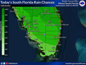
Here in South Florida, Sunday’s forecast features periods of gusty winds and downpours to start in the east coast metro area.  Then conditions improve as the day progresses.  The Gulf coast will see a mix of sun and clouds with periods of showers and storms.  Highs on Sunday will be near 90 degrees.

Monday will bring partly sunny skies to the Gulf coast, plenty of clouds in the east coast metro area, and widespread showers and storms everywhere as we deal with the “tail” of Isaias.  Monday’s highs will be in the low 90s.

Tuesday will feature a mix of sun and clouds along the Gulf coast and lots of clouds in the east coast metro area.  All of South Florida can expect periods of showers and storms.  Tuesday’s highs will be mostly in the upper 80s.

Wednesday will be another day of widespread showers and storms.  We’ll also see some sun but more clouds.  Wednesday’s highs will be in the low 90s.

Thursday’s forecast includes clouds, showers, and storms.  Highs on Thursday will be near 90 degrees.
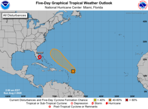
We’re also keeping an eye on the rest of the tropics. What was Tropical Depression # 10 is now a remnant low in the eastern Atlantic.  The wave in the central Atlantic has a medium chance of developing into a depression during the next 5 days.  This feature is forecast to take a turn to the northwest and then north, remaining well east of Florida.

Donna Thomas has studied hurricanes for two decades. She holds a PhD in history when her experience with Hurricane Andrew ultimately led her to earn a degree in broadcast meteorology from Mississippi State University. Donna spent 15 years at WFOR-TV (CBS4 in Miami-Fort Lauderdale), where she worked as a weather producer with hurricane experts Bryan Norcross and David Bernard. She also produced hurricane specials and weather-related features and news coverage, as well as serving as pool TV producer at the National Hurricane Center during the 2004 and 2005 seasons. Donna also served as a researcher on NOAA's Atlantic Hurricane Database Reanalysis Project. Donna specializes in Florida's hurricane history.