Home Weather Showers And Storms Return To Florida Sunday

Showers And Storms Return To Florida Sunday

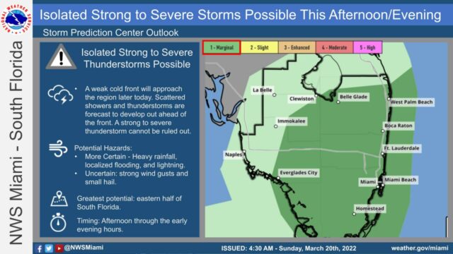
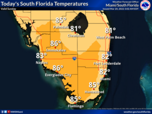
Sunday begins with fog near the Gulf coast and in the interior.  Then the day features good sun and a few clouds in the morning, but look for showers and storms in the afternoon in the east coast metro area as a front moves in.  Localized flooding is possible.  A high risk of dangerous rip currents is in place at the Atlantic beaches, and there’s a moderate rip current risk along the Gulf coast.  Highs on Sunday will be in the mid-80s.

LIVE RADAR 24/7 (Click Here Then Press Play)

Monday will bring lots of sun and a gusty breeze to the Gulf coast, while the east coast metro area will see breezy conditions, a mix of sun and clouds, and maybe a quick shower in spots.  Monday’s highs will be near 80 degrees in the east coast metro area and in the mid-80s along the Gulf coast.

Tuesday will be a breezy day with good sun and a few clouds.  Tuesday’s highs will be in the low 80s in the east coast metro area and in the mid to upper 80s along the Gulf coast.

Wednesday will feature breezy conditions and good sun, a few clouds, and passing showers in spots.  Wednesday’s highs will be in the mid-80s.

Thursday’s forecast calls for a mix of sun, clouds, and periods of showers.  Highs on Thursday will be in the mid-80s.

Donna Thomas has studied hurricanes for two decades. She holds a PhD in history when her experience with Hurricane Andrew ultimately led her to earn a degree in broadcast meteorology from Mississippi State University. Donna spent 15 years at WFOR-TV (CBS4 in Miami-Fort Lauderdale), where she worked as a weather producer with hurricane experts Bryan Norcross and David Bernard. She also produced hurricane specials and weather-related features and news coverage, as well as serving as pool TV producer at the National Hurricane Center during the 2004 and 2005 seasons. Donna also served as a researcher on NOAA's Atlantic Hurricane Database Reanalysis Project. Donna specializes in Florida's hurricane history.