


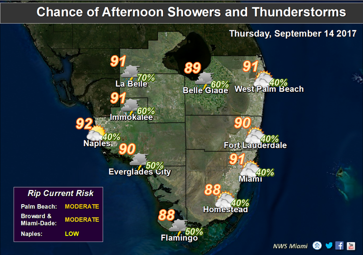
 South Florida will be muggy with afternoon storms on Thursday as the recovery from Hurricane Irma continues. After a mostly dry morning, Thursday will bring muggy conditions, building clouds, and afternoon storms, especially inland. Highs on Thursday will be near 90 degrees, but it will feel like the triple digits — so be careful working outdoors.
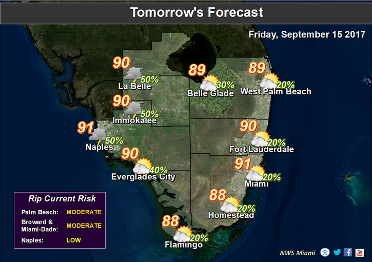 Friday will bring slightly drier air, with a mix of sun and clouds. A strong sea breeze should keep most of the afternoon storms west of the metro area. Highs on Friday will be near 90 degrees.
Look for a few early showers, a mix of sun and clouds, and a stray afternoon storm on Saturday. Saturday’s highs will be in the low 90s.
More of the same is on tap for Sunday — an early shower in spots, sun and clouds, and maybe an afternoon storm. Highs on Sunday will be in the low 90s.
We’ll see a mix of sun and clouds and a few afternoon storms on Monday. Monday’s highs will be near the 90 degrees.
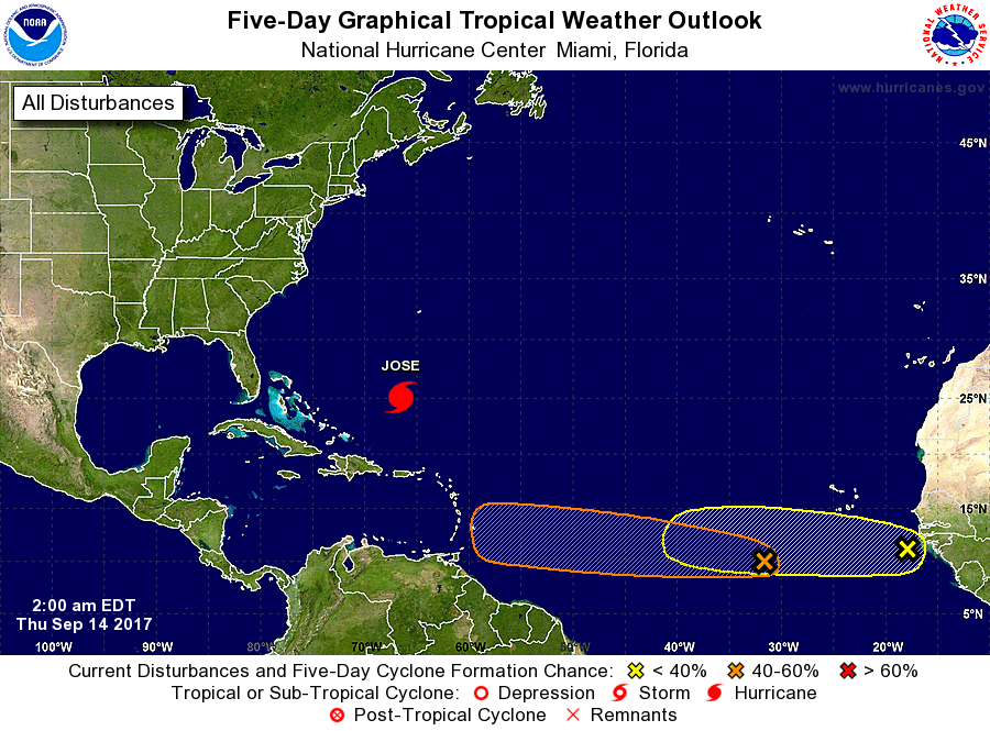 In the tropics, Hurricane Jose is several hundred miles east of the Bahamas and looping slowly during the next day or so — and it’s no threat to Florida. At 5 am Thursday, Jose was located near 25.1 North, 66.5 West, and was crawling west at 3 miles per hour. Maximum sustained winds were 75 miles per hour. Elsewhere, a wave near the African coast has a low chance of developing during the next 5 days.


