


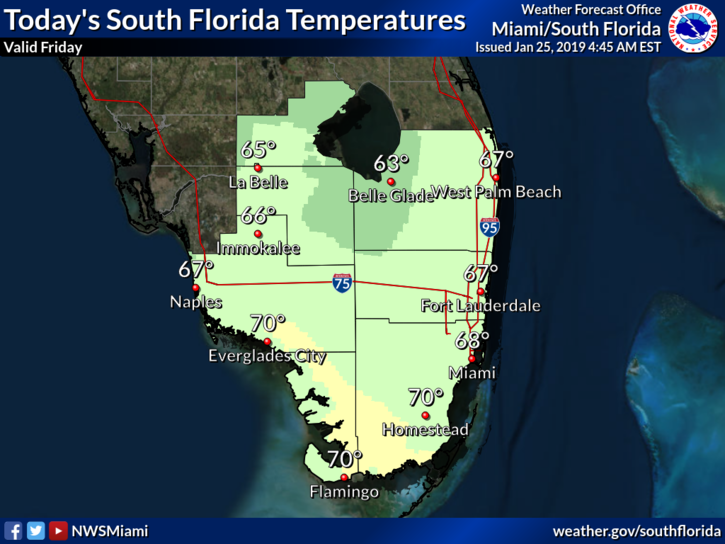
 South Florida is cooler and drier on Friday, but more rain is on the way for the weekend and beyond. In the meantime, Friday features plenty of clouds and some sun. An elevated risk of dangerous rip current threat continues at the Gulf beaches. Highs on Friday will be in the upper 60s.
Saturday morning will be chilly, with lows ranging from the upper 40s at the Gulf coast to the mid 50s right at the Atlantic coast. Then the day will bring clouds and periods of showers as a front approaches. Saturday’s highs will be in the upper 60s.
The front stalls over our area, making Saturday night and Sunday rainy, cloudy, and chilly. Sunday’s highs will be in the mid to upper 60s.
After Monday morning lows in the 50s, the day will be cloudy and rainy. Monday’s highs will be in the upper 60s.
Look for some sun to peek through the clouds on Tuesday, and shower chances will diminish. Highs on Tuesday will be in the mid 70s.


