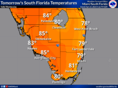
Sunday features lots of hot sun and a few clouds on a warm breeze. A high risk of dangerous rip currents remains along the Palm Beach County coast, and there’s a moderate rip current risk at the beaches of Broward and Miami-Dade. Highs on Sunday will be mostly in the upper 80s in the east coast metro area and in the mid 80s along the Gulf coast.
LIVE RADAR 24/7 (Click Here Then Press Play)
Monday will be breezy with a mix of sun, clouds, and showers. Some storms are possible in the afternoon and evening. Monday’s highs will be in the upper 80s in the east coast metro area and the mid 80s along the Gulf coast.
Tuesday will feature some sun, more clouds, and some showers and storms on a gusty breeze as a front moves in. Tuesday’s highs will be in the low 80s.
Wednesday morning will be cool, with lows ranging from the upper 50s to the low 60s. The day will be on the cloudy side with showers on a gusty breeze. Wednesday’s highs will be in the mid 70s.
Thursday’s forecast calls for lots of sun. Highs on Thursday will be mostly in the upper 70s in the east coast metro area and in the low 80s along the Gulf coast.


