Home Weather It’s All About Hurricane Dorian (5AM Update)

It’s All About Hurricane Dorian (5AM Update)

Hurricane Dorian

 It’s all about Hurricane Dorian on Thursday through the Labor Day weekend.  Everyone on the Florida peninsula — including here in South Florida — will need to keep in touch with the latest weather information and be prepared to act when watches — and possibly warnings — are issued.

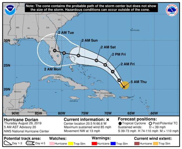
At 5 am Thursday, Dorian was located near 20.5 North, 66.6 West, about 150 miles north-northwest of San Juan, Puerto Rico.  Maximum sustained winds were 85 miles per hour, and Dorian was moving northwest at 13 miles per hour.  There was no intensification overnight, and some dry air has gotten into the circulation.  Despite this, we’re looking at a very powerful and dangerous hurricane approaching Florida on a holiday weekend.
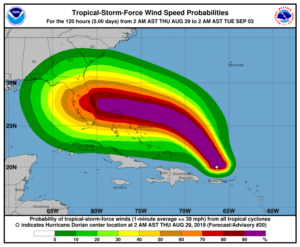
The key variable in Dorian’s future intensity is the very warm water it will be traveling over.  The National Hurricane Center forecast calls for a category 3 hurricane at landfall on Monday.  Don’t be surprised if Dorian intensifies very quickly on Thursday or Friday. Given the environment Dorian is traveling through, this is quite possible.

Dorian’s track is dependent on when a high — which will block the hurricane’s northward movement — slides westward, and where Dorian is when that happens. So we’ll be watching to see when and where Dorian makes a turn to the west-northwest.  That will help determine which areas will see the greatest effects from the hurricane.  But we probably won’t know that until Friday.  In the meantime, most of Florida and portions of Georgia are in a very wide 4-to-5-day cone.
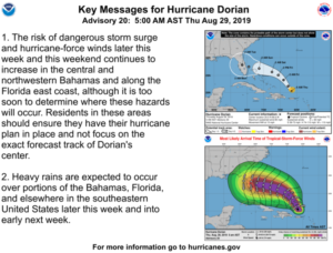
Keep in touch with Dorian’s progress, but take this “waiting period” to do those hurricane preparations you know you should have done back in June.  Don’t wait for the last minute, when you know you’ll have to deal with long lines everywhere.  And look at all aspects of your hurricane plan, including where you would go if you live in an evacuation zone.  Check your shutters to make sure you have all the parts, and clear some time to install them during the day on Saturday if that becomes necessary.

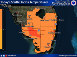
As for our local weather, Thursday features a mix of sun and clouds with periods of showers and storms.  Heavy rain is possible in spots.  Highs on Thursday will be in the humid low 90s.

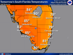
Friday will bring sun and clouds at times but periods of showers and storms throughout the day.  Friday’s highs will be near 90 degrees.

Look for clouds, showers, and storms on Saturday, and the east coast metro area could see gusts to tropical storm force and periods of heavy rain on Saturday night.  Saturday’s highs will be in the upper 80s.

Our weather on Sunday and Monday will be totally dependent on Dorian.  Look for clouds, gusty winds, and downpours at times as a best-case scenario.  Highs will be in the humid upper 80s.

Stay informed and stay safe.

[vc_message message_box_style=”solid-icon” message_box_color=”blue”]By Donna Thomas, SouthFloridaReporter.com, certified Meteorologist, Aug. 29, 2019[/vc_message]
Donna Thomas has studied hurricanes for two decades. She holds a PhD in history when her experience with Hurricane Andrew ultimately led her to earn a degree in broadcast meteorology from Mississippi State University. Donna spent 15 years at WFOR-TV (CBS4 in Miami-Fort Lauderdale), where she worked as a weather producer with hurricane experts Bryan Norcross and David Bernard. She also produced hurricane specials and weather-related features and news coverage, as well as serving as pool TV producer at the National Hurricane Center during the 2004 and 2005 seasons. Donna also served as a researcher on NOAA's Atlantic Hurricane Database Reanalysis Project. Donna specializes in Florida's hurricane history.