


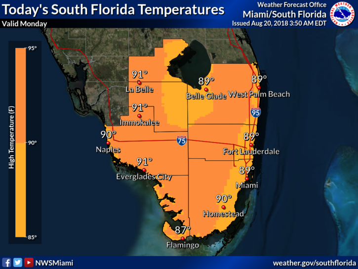
 South Florida will see the usual summertime mix of sun and storms on Monday. After some early east coast showers, Monday features a mix of sun and clouds with midday showers and storms along the Atlantic sea breeze. Then the activity shifts inland and along the Gulf coast in the afternoon and early evening. Some storms could build back over portions of the east coast metro area late in the day and during the evening as well. Highs on Monday will be near 90 degrees near the east coast and the low 90s elsewhere.
Tuesday will bring a mix of sun and clouds and fewer showers and storms. Tuesday’s highs will be near 90 degrees near the coasts and the low 90s well inland.
Wednesday will feature sun, clouds, and afternoon showers and storms in spots. Wednesday’s highs will be in the low 90s.
More moisture will move in on Thursday, so look for more widespread showers and storms around South Florida. Thursday’s highs will be in the low 90s.
Friday’s forecast includes some sun, clouds, and periods of showers and storms. Highs on Friday will be in the low 90s.
The tropics are quiet right now.


