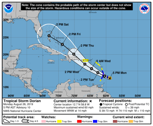
Tropical Storm Dorian is on the move just southeast of Barbados late on Monday afternoon. There is now a tropical storm watch for Puerto Rico, and additional watches and warnings are likely by early on Tuesday. And as expected, South Florida is in the 4-to-5-day “cone.”
At 5 pm Monday, Dorian was located near 12.7 North, 58.8 West, and was moving west-northwest at 14 miles per hour. Maximum sustained winds were still 60 miles per hour, but Dorian is expected to become a hurricane before its closest approach to Puerto Rico.
Dorian is expected to move over the Bahamas on Friday into Saturday, and warm ocean waters will allow strengthening, even if the system is disrupted by the mountains of Puerto Rico and Hispaniola. The latest computer model runs indicate at least a strong tropical storm (possibly a weak hurricane) as Dorian makes its closest approach to South Florida, probably on Saturday evening.
Now is the time to review your hurricane plan, get any hurricane supplies you need, make sure your vehicles have gas, and wait to see if it will be necessary to put up hurricane shutters. And make sure you keep up to date on Dorian’s progress.


