


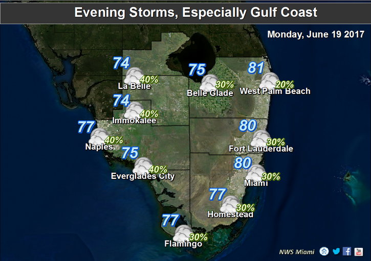
 As showers and storms move into South Florida today, we’ll be watching two systems in the tropics. Tropical moisture streaming northeastward from the disturbance near the Yucatan will bring in passing showers and afternoon storms on Monday. We’ll also see a high risk of dangerous rip currents at the Atlantic beaches. Monday’s highs will be mostly in the upper 80s.
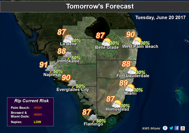 Look for showers, and storms on Tuesday, along with periods of sun and clouds. Highs on Tuesday will be in the upper 80s.
We’ll see more sun, some morning coastal showers, and afternoon storms on Wednesday. Wednesday’s highs will be near 90 degrees.
Thursday will start with a mix of sun and clouds, and some afternoon storms will develop, especially inland. Highs on Thursday will be near 90 degrees.
Look for a mix of sun and clouds, with maybe an afternoon storm in spots, on Friday. Friday’s highs will be near 90 degrees.
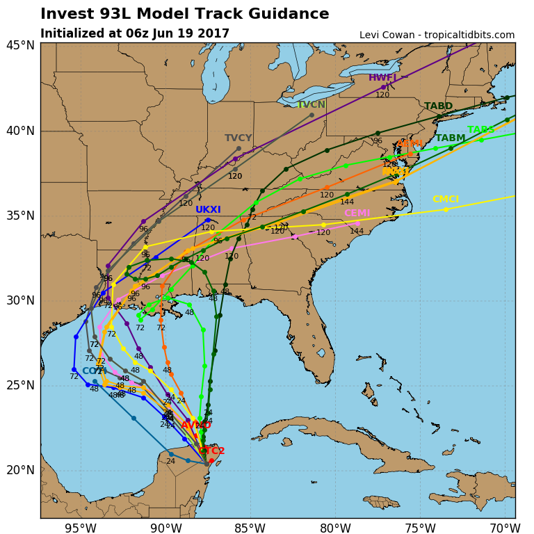 The tropics are getting busy. Closer to us, the disturbance near the Yucatan has a high chance of becoming a tropical depression as it moves into the southwestern Gulf of Mexico during the next day or so. It is forecast to move toward the northern Gulf coast.
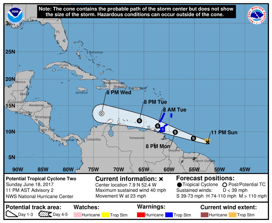 The wave in the Atlantic is now being called Potential Tropical Cyclone # 2 by the National Hurricane Center. That’s an unusual designation for an unusual system that is surprisingly early. It doesn’t yet have a closed circulation, but it does have tropical storm force winds. At 5 am Monday, it was located near 8.4 North, 54.5 West and was moving west at 23 miles per hour. Tropical Storm Warnings are up for the southern Windward Islands, including Trinidad. This system should be at least a depression as early as today. The system will encounter hostile wind shear in the eastern Caribbean and is forecast to dissipate in a few days.


