


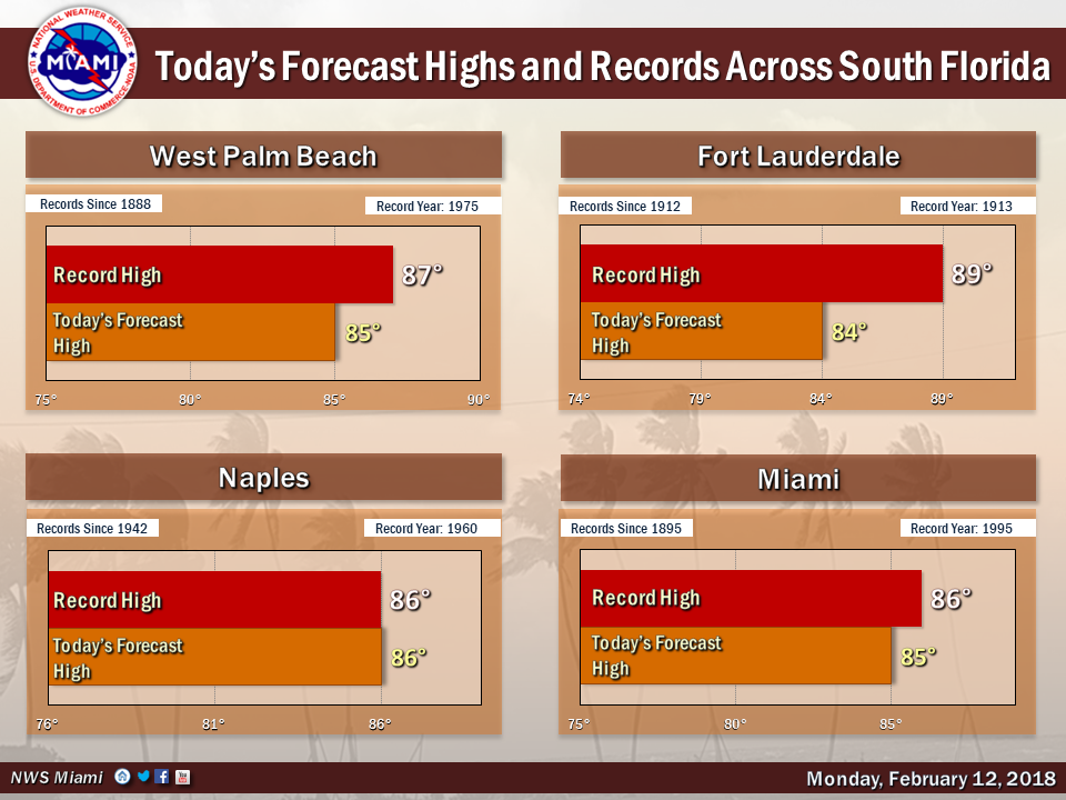
 South Florida will be warm again on Monday as we continue to break records for mid-February. After a warm start with a stray shower in spots, Monday features a mix of sun and clouds with a few passing showers. A high risk of dangerous rip currents continues at the Atlantic beaches. Highs on Monday will be in the mid 80s (and some interior locations could reach the upper 80s).
Tuesday will bring more of the same — sun, clouds, and a few showers on another warm winter day. Tuesday’s highs will be in the mid 80s.
Our forecast for Valentine’s Day includes a mix of sun and clouds and some showers at times. Wednesday’s highs will be in the mid 80s again.
Thursday will be mostly sunny with a few showers as temperatures moderate a bit. Thursday’s highs will be in the low 80s.
Friday will feature good sun with a cloud at times and the chance of a stray shower. Highs on Friday will be in the low 80s.


