


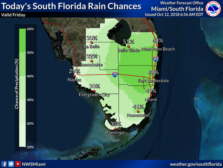
 South Florida will see tropical heat, showers, and storms on Friday as we’re stuck in moisture left over from Michael. Friday starts with early showers along the Gulf coast and some fog in the east coast metro area. Then we’ll see some sun, clouds, and periods of showers and storms, especially in the afternoon. Highs on Friday will be in the unseasonable low 90s.
Some drier air works its way in on Saturday, so rain chances will decrease. Saturday’s highs will be in the upper 80s at the coasts and a bit warmer inland.
Look for sun, clouds, passing showers, and a few storms in spots on Sunday. Sunday’s highs will be near 90 degrees.
Monday will bring sun with some clouds and showers on an ocean breeze. Monday’s highs will be in the upper 80s.
Tuesday’s forecast includes some sun, breezy conditions, and passing showers. Highs on Tuesday will be in the upper 80s.
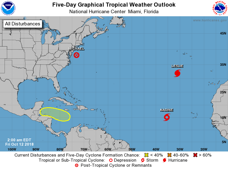 Michael is now a post-tropical system and is racing away from the U.S. coast. At 5 am Friday, Michael was near 38.0 North, 73.1 West, and was zipping east-northeast at 29 miles per hour. Maximum sustained winds were 65 miles per hour. It’s expected to die out near the coast of Europe.
Elsewhere, Hurricane Leslie has accelerated. At 5 am Friday, Leslie was located near 31.9 North, 31.0 West, and was racing east-northeast at 28 miles per hour. Maximum sustained winds were 90 miles per hour. Leslie will skirt the African coast before finally weakening to a depression in a few days. And Tropical Storm Nadine is expected to dissipate this weekend. At 5 am Friday, Nadine was located near 15.2 North, 35.5 West, and was moving west-northwest at 8 miles per hour. Maximum sustained winds in Leslie were 50 miles per hour.


