


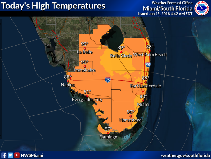
 South Florida won’t escape afternoon and evening storms again on Friday, but the weekend is looking to be less active. Friday will start with a mix of sun and clouds, but the sea breezes will trigger showers and storms during the early afternoon, lasting into the early evening. Highs on Friday will be near 90 degrees.
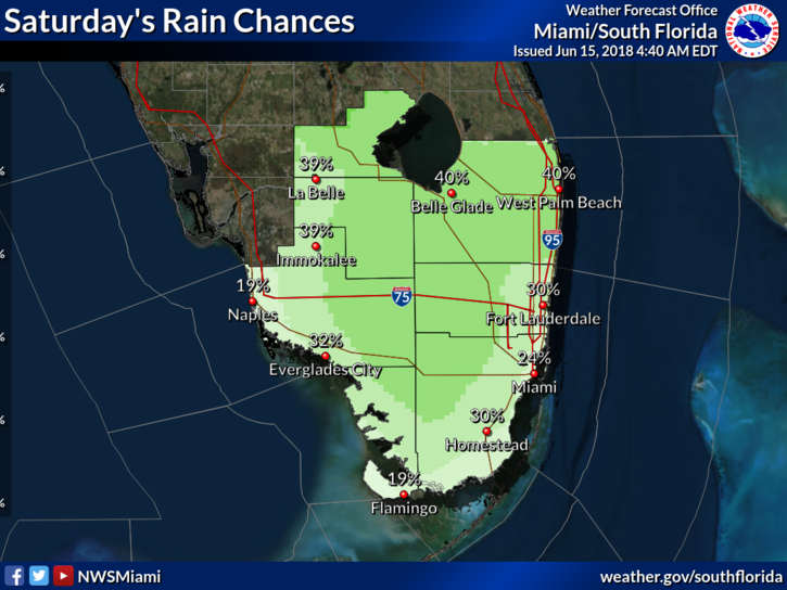 Saturday will bring sun and clouds to start, and afternoon storms will develop, especially in the interior. Saturday’s highs will be near 90 degrees.
Fathers Day will feature sun, clouds, and fewer afternoon storms as Sahara dust works it way into the area. We will need to watch for an increasing risk of dangerous rip currents at the Atlantic beaches. Sunday’s highs will be near 90 degrees.
Look for sun and a few clouds to start on a hazy Monday. An isolated storm is possible, especially in the interior. Dangerous rip currents will be a threat at the Atlantic beaches on Monday. Monday’s highs will be mostly in the low 90s.
Tuesday’s forecast includes sun, a few clouds, and maybe a stray late-day storm. Highs on Tuesday will be near 90 degrees.
In the tropics, the area of showers and storms now over the Yucatan is not expected to develop into a tropical depression. But it will bring heavy rains to portions of Mexico during the next few days.


