Home Weather Hot Today As Tropical Wave To Adversely Affect Our Weekend Weather

Hot Today As Tropical Wave To Adversely Affect Our Weekend Weather

tropical wave

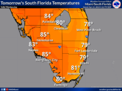
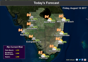
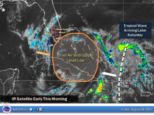
tropical waveSouth Florida will be hot and mostly dry on Friday, but we’re watching a tropical wave that could affect our weather by the middle of next week. Friday features some drier air moving in, so look for hazy sun, a few clouds, and just the chance of a stray storm, especially well inland. Highs on Friday will be in the sweltering mid 90s, so stay hydrated and out of the sun.

tropical waveSaturday will start out on the dry side, but moisture will move in by late morning. Showers and storms will develop in the afternoon, bringing periods of heavy rain. Saturday’s highs will be near 90 degrees.

Sunday will be another unsettled day, with clouds, showers, and storms around. Periods of heavy rain could lead to localized flooding. Highs on Sunday will be near 90 degrees.

Monday features a few early showers, a mix of sun and clouds, and a few afternoon storms as we watch (with the proper eye protection) the partial eclipse. Monday’s highs will be in the low 90s.

Our weather on Tuesday will depend on the tropics — but for now we’ll say to plan for periods of heavy rain and gusty winds late in the day, along with highs near 90 degrees.
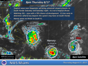
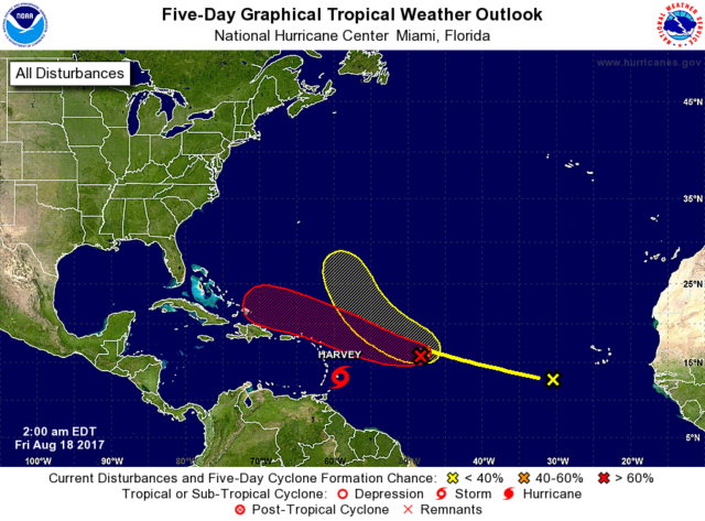
In the tropics, we’re especially concerned with the wave that is now about 900 miles east of the Leeward Islands. It has a high chance of developing into a depression — but it will also be entering an area of unfavorable conditions by late in the weekend. Computer models show the system (or its remnants) in our area by midweek. Whatever this wave’s future, take some time this weekend to check your supplies and update your hurricane plan — just in case.

Elsewhere, the wave passing through the Windward Islands is now Tropical Storm Harvey. At 5 am Friday, Harvey was located near 13.1 North, 59.1 West, and was moving west at 18 miles per hour. Maximum sustained winds were 40 miles per hour, but Harvey is forecast to strengthen into a hurricane before making landfall in Central America.

Finally, the wave in the far eastern Atlantic has a low chance of developing during the next 5 days, and we’re saying goodbye to Gert, which has lost its tropical characteristics as it weakens over the northern Atlantic.

Donna Thomas has studied hurricanes for two decades. She holds a PhD in history when her experience with Hurricane Andrew ultimately led her to earn a degree in broadcast meteorology from Mississippi State University. Donna spent 15 years at WFOR-TV (CBS4 in Miami-Fort Lauderdale), where she worked as a weather producer with hurricane experts Bryan Norcross and David Bernard. She also produced hurricane specials and weather-related features and news coverage, as well as serving as pool TV producer at the National Hurricane Center during the 2004 and 2005 seasons. Donna also served as a researcher on NOAA's Atlantic Hurricane Database Reanalysis Project. Donna specializes in Florida's hurricane history.