

 Tuesday features plenty of hot sun with a few storms and showers developing in spots during the afternoon. Highs on Tuesday will be in the low 90s, but it will feel like the triple digits.
LIVE RADAR 24/7 (Click Here Then Press Play)
Wednesday will bring hazy sun and a few afternoon showers and storms as some Saharan dust filters in (but the bulk of it is expected to stay south of us). Wednesday’s highs will be in the low 90s.
Thursday will be hazy with hot sun. Look for a few showers and storms during the afternoon. Thursday’s highs will be in the low 90s.

Friday will feature hazy skies, hot sun, and a few storms in spots. Friday’s highs will be mostly in the low 90s, but some inland locations could hit the mid 90s.
Saturday’s forecast will feature good sun, some clouds at times, and afternoon showers and storms. Highs on Saturday will be in the low 90s.
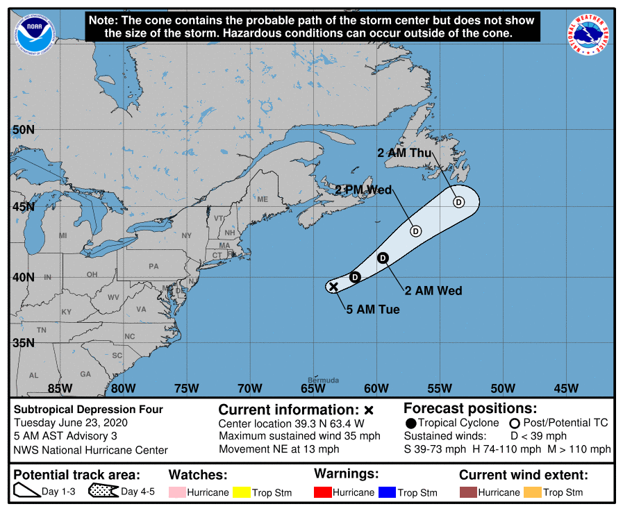 The low we’ve been watching became Subtropical Depression # 4 late Monday afternoon. At 5 am Tuesday, TD # 4 was located near 39.3 North, 63.4 West, about 365 miles south of Nova Scotia. Maximum sustained winds were 35 miles per hour, and TD # 4 was moving northeast at 13 miles per hour. Computer models indicate this system will dissipate in the north-central Atlantic in a couple of days.
Disclaimer
Artificial Intelligence Disclosure & Legal Disclaimer
AI Content Policy.
To provide our readers with timely and comprehensive coverage, South Florida Reporter uses artificial intelligence (AI) to assist in producing certain articles and visual content.
Articles: AI may be used to assist in research, structural drafting, or data analysis. All AI-assisted text is reviewed and edited by our team to ensure accuracy and adherence to our editorial standards.
Images: Any imagery generated or significantly altered by AI is clearly marked with a disclaimer or watermark to distinguish it from traditional photography or editorial illustrations.
General Disclaimer
The information contained in South Florida Reporter is for general information purposes only.
South Florida Reporter assumes no responsibility for errors or omissions in the contents of the Service. In no event shall South Florida Reporter be liable for any special, direct, indirect, consequential, or incidental damages or any damages whatsoever, whether in an action of contract, negligence or other tort, arising out of or in connection with the use of the Service or the contents of the Service.
The Company reserves the right to make additions, deletions, or modifications to the contents of the Service at any time without prior notice. The Company does not warrant that the Service is free of viruses or other harmful components.


