Home Weather Heavy Rain For Florida This Weekend

Heavy Rain For Florida This Weekend

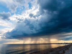
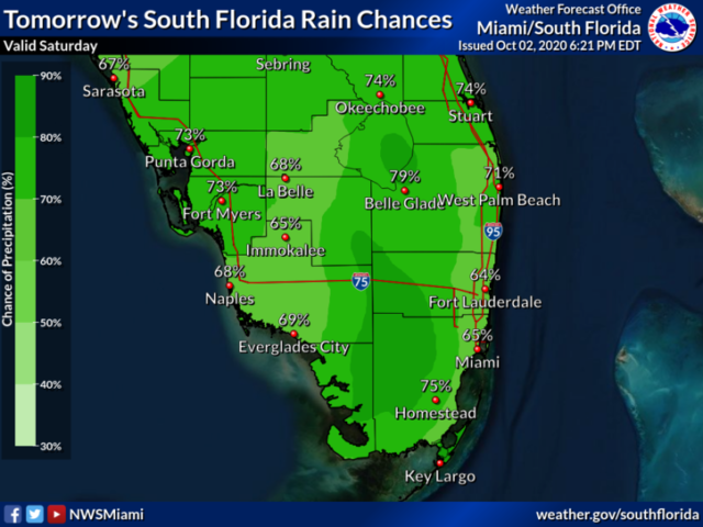
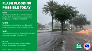
Saturday features lots of clouds and periods of showers and storms.  Heavy downpours are possible, and so is flash flooding.  A flood watch is in effect through Sunday evening in the east coast metro area.  Highs on Saturday will be in the mid-80s.

LIVE RADAR 24/7 (Click Here Then Press Play)

Sunday will be cloudy and rainy, with a building breeze near the Atlantic coast. The bulk of the showers and storms will be in the western part of our area, but periods of heavy rain and localized flooding are still possible in the east coast metro area.  Sunday’s highs will be in the upper 80s.

Monday will see the return of the sun, but we’ll also see periods of showers and storms.  Monday’s highs will be in the upper 80s.

Tuesday will feature mostly sunny skies in the morning and showers and storms on a brisk breeze in the afternoon.  Tuesday’s highs will be in the upper 80s.

Wednesday’s forecast calls for good sun alternating with showers and storms.  Highs on Wednesday will be in the upper 80s.
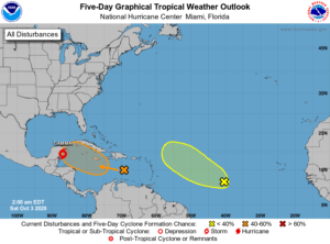
In the tropics, Tropical Depression # 25 is now Tropical Storm Gamma.  At 5 am Saturday, Gamma was located near 19.4 North, 86.9 West, about 75 miles south of Cozumel, Mexico.  Gamma was moving northwest at 9 miles per hour and had maximum sustained winds of 50 miles per hour.  A tropical storm warning is in effect for much of the Yucatan coast.  Gamma is forecast to move slowly in the southwestern Gulf of Mexico.

Elsewhere, the tropical wave that’s now entering the central Caribbean has a medium chance of becoming a depression during the next 5 days.  And a wave that’s about halfway between Africa and the Lesser Antilles has a low chance of developing by the middle of next week.

Donna Thomas has studied hurricanes for two decades. She holds a PhD in history when her experience with Hurricane Andrew ultimately led her to earn a degree in broadcast meteorology from Mississippi State University. Donna spent 15 years at WFOR-TV (CBS4 in Miami-Fort Lauderdale), where she worked as a weather producer with hurricane experts Bryan Norcross and David Bernard. She also produced hurricane specials and weather-related features and news coverage, as well as serving as pool TV producer at the National Hurricane Center during the 2004 and 2005 seasons. Donna also served as a researcher on NOAA's Atlantic Hurricane Database Reanalysis Project. Donna specializes in Florida's hurricane history.