


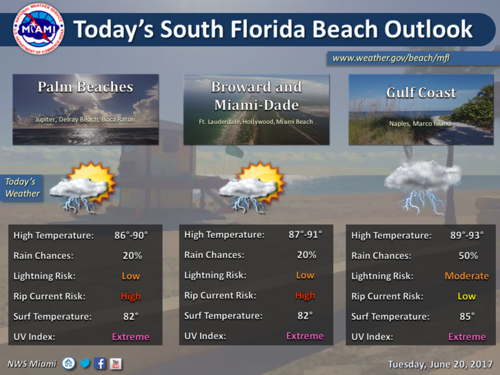
 South Florida will see some breezy showers on Tuesday as the tropics get busy early. Tuesday features a mix of sun and clouds with showers passing through on the strong ocean breeze. A high risk of dangerous rip currents remains in place at the Atlantic beaches at least through Tuesday. Tuesday’s highs will be near 90 degrees.
Look for passing showers and some storms on Wednesday, along with periods of sun and clouds. Wednesday’s highs will be in the low 90s.
Thursday will bring a mix of sun and clouds, passing showers at times, and an inland storm or two. Highs on Thursday will be in the low 90s.
Friday’s forecast includes a mix of sun and clouds with a possible afternoon storm well inland. Friday’s highs will be in the low 90s.
Sun, clouds, and a few afternoon storms will be around on Saturday. Highs on Saturday will be near 90 degrees.
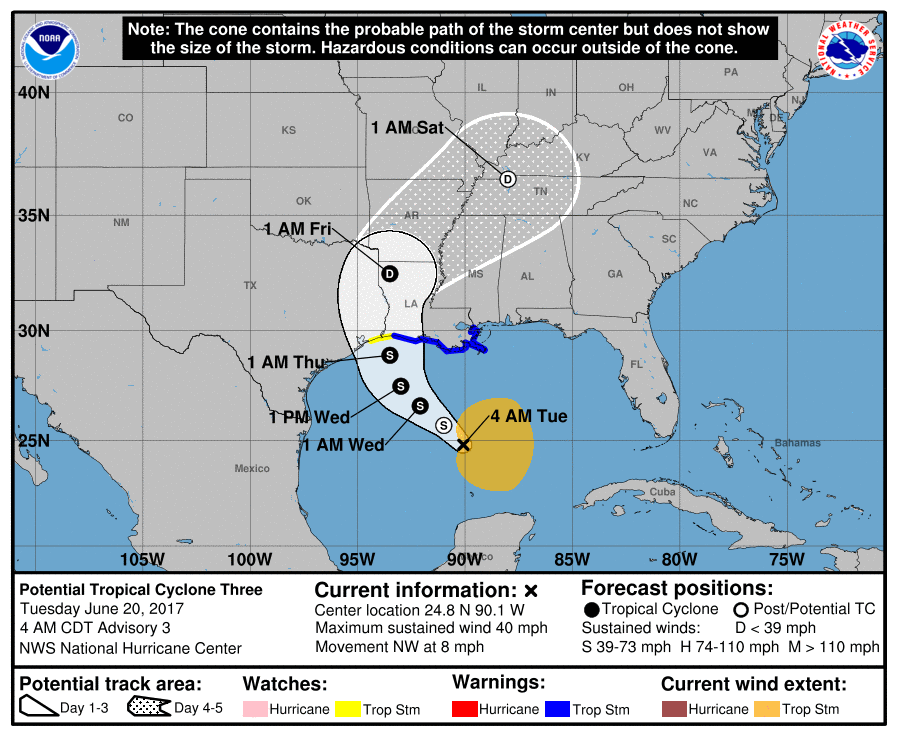 In the tropics, we’re watching Potential Tropical Cyclone # 3 as it moves into the Gulf of Mexico. It doesn’t yet have a closed center of circulation, but it does have tropical storm force winds and is expected to develop quickly. At 5 am Tuesday, it was located near 24.8 North, 90.1 West, about 335 miles south-southeast of Morgan City, Louisiana. The system was moving northwest at 8 miles per hour, with maximum sustained winds of 40 miles per hour. Tropical storm warnings are up for coastal Louisiana and parts of the Texas coast. The system will bring flooding rain and strong winds to the northern Gulf coast, including the Florida panhandle, late Wednesday and early Thursday.
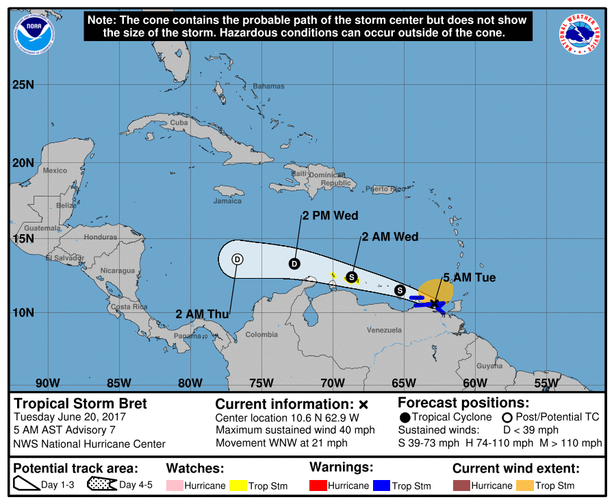 Far to the south, what was Potential Tropical Cyclone # 2 is now Tropical Storm Bret. At 5 am Tuesday, Bret was located near 10.6 North, 62.9 West and was zipping west-northwestward at 21 miles per hour. Maximum sustained winds were 40 miles per hour. Bret will hug the South American coast and bring heavy rain and strong winds extending into the southern Windward Islands and Curacao. Bret is expected to weaken as it encounters hostile conditions in the eastern and central Caribbean.


