NOTE: We will update information on Idalia as it becomes available.
1130am Update
As Idalia approaches and strengthens, there are new watches and warnings for portions of Florida.
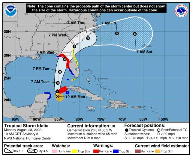
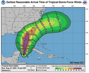
A hurricane warning is now in effect from the middle of Longboat Key northward to the Ochlockonee River. This includes the Tampa Bay region.
There is now a storm surge warning from Englewood northward to the Ochlockonee River. Storm surge amounts from 2 to 4 feet all the way to 7 to 11 feet are possible within the warning area.
A tropical storm warning is now in effect from Chokoloskee northward to the middle of Longboat Key. This includes the Naples area and Fort Myers.
There is also a tropical storm watch for the Atlantic coast, from Sebastian Inlet northward to Altamaha Sound, Georgia.
The entire Gulf coast from Chokoloskee northward to Indian Pass in the Florida panhandle is now under watches or warnings. There is a tropical storm watch already in effect for the Lower Keys, from Key West to the Seven Mile Bridge, as well as a tropical storm warning for Dry Tortugas.
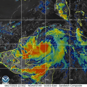
At 11 am Monday, Idalia was still a tropical storm with maximum sustained winds of 65 miles per hour, but it is expected to reach hurricane strength by Monday evening. Idalia was located near 20.8 North, 85.2 West, about 305 miles south-southwest of Dry Tortugas late Monday morning. At that time, Idalia was moving north at 8 miles per hour. The forecast calls for Idalia to become a major hurricane before making landfall in the hurricane warning area late Tuesday night into Wednesday morning.
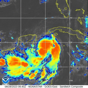 Tropical Storm Idalia is strengthening, and it is now forecast to become a major hurricane before making landfall on the Gulf coast north of our area. But portions of South Florida will feel tropical storm force winds, starting as early as tonight.
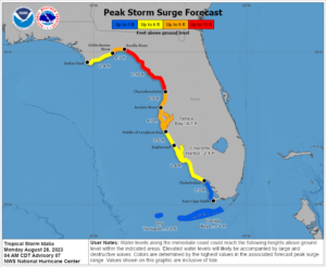 Storm surge flooding is also likely, which will be enhanced by flooding at high tide.
LIVE RADAR 24/7 (Click Here Then Press Play)
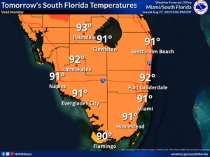
Wednesday will be windy with some sun, more clouds, early showers, and plenty of afternoon and evening storms. Look for winds to diminish a bit during the evening as Idalia moves well to our north, but it will remain breezy as we experience the “tail” of the storm. Wednesday’s highs will be in the low 90s.
Thursday will be breezy with mostly sunny skies and periods of showers and storms. Thursday’s highs will be mostly in the humid mid-90s in the East Coast metro area and in the low 90s along the Gulf Coast and in the Keys.
Friday’s forecast calls for lots of hot sun with periods of showers and storms. Highs on Friday will be in the mid-90s.
