Home Weather Strong to Severe Storms Likely

Strong to Severe Storms Likely

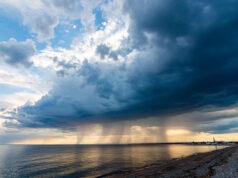
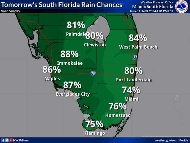
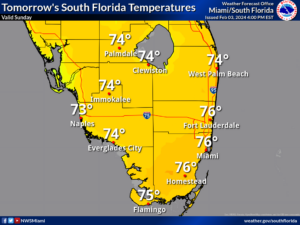
Sunday features breezy conditions, lots of clouds, and periods of showers and storms as a strong front moves through South Florida.  Strong to severe storms are likely in the morning and early afternoon, with the storms arriving by midmorning in western portions of South Florida and reaching the East Coast metro area by late morning.  Damaging winds, dangerous lightning, and periods of heavy rain are possible on Sunday.  A high risk of dangerous rip currents remains along the Palm Beach County coast, and there’s an elevated rip current risk at the rest of South Florida’s beaches.  Highs on Sunday will be mostly in the upper 70s in the East Coast metro area and the Keys and in the mid-70s along the Gulf Coast.

Monday will bring more clouds than sun, periods of showers, and a gusty breeze.  Monday’s highs will be in the low 70s in the Miami-Dade and Broward suburbs, near 70 degrees in the Keys, and in the upper 60s right at the Atlantic coast and along the Gulf Coast.

Tuesday morning will be chilly, with lows mostly in the 50s.  The day will be sunny but windy.  A stray shower is possible in the East Coast metro area.  Tuesday’s highs will be near 70 degrees in the east coast metro area and the Keys and in the upper 60s along the Gulf Coast.

Wednesday will feature another chilly morning with lows in the 50s.  Then look for lots of sun with a cool and gusty breeze.  A shower is possible in spots in the East Coast metro area.  Wednesday’s highs will be in the low 70s in the East Coast metro area and near 70 degrees along the Gulf Coast and in the Keys.

Thursday’s forecast calls for another chilly start, followed by lots of sun and a few clouds at times.  Highs on Thursday will be in the low 70s in the East Coast metro area and the mid-70s along the Gulf Coast and in the Keys.

Donna Thomas has studied hurricanes for two decades. She holds a PhD in history when her experience with Hurricane Andrew ultimately led her to earn a degree in broadcast meteorology from Mississippi State University. Donna spent 15 years at WFOR-TV (CBS4 in Miami-Fort Lauderdale), where she worked as a weather producer with hurricane experts Bryan Norcross and David Bernard. She also produced hurricane specials and weather-related features and news coverage, as well as serving as pool TV producer at the National Hurricane Center during the 2004 and 2005 seasons. Donna also served as a researcher on NOAA's Atlantic Hurricane Database Reanalysis Project. Donna specializes in Florida's hurricane history.