

 Monday features lots of sun along the Gulf coast, while the east coast metro area will be cloudy with the chance of a stray shower to start and mostly sunny in the afternoon. A high risk of dangerous rip currents is in place along the Palm Beach County coast until midweek, and there’s a moderate rip current risk at the beaches of Broward and Miami-Dade. Highs on Monday will be in the mid-70s.
LIVE RADAR 24/7 (Click Here Then Press Play)
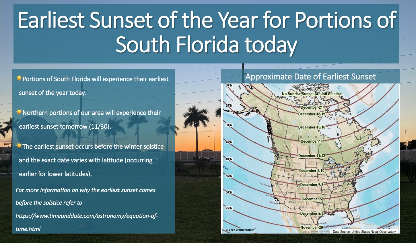 Did you know that today’s sunset is actually the earliest of the year for potions of our area (north of Miami you will have to wait until tomorrow though)? It will be very gradual but our sunsets will get later going forward and the sunset on the solstice (December 21st) will actually be about 5 minutes later than today’s.
Tuesday morning will be quite cool, with lows in the 50s. Plenty of sun will follow in the afternoon. Tuesday’s highs will be mostly in the mid-70s.

Wednesday will start with another cool morning, with lows ranging from the mid-50s to the low 60s. Then we’ll see lots of sun and a few clouds. Wednesday’s highs will be in the upper 70s.
Thursday will feature a mix of sun and clouds as temperatures inch upward. Thursday’s highs will be in the low 80s in the east coast metro area and the upper 70s along the Gulf coast.
Friday’s forecast calls for lots of sun and a few clouds at times. Highs on Friday will be in the low 80s.
Disclaimer
Artificial Intelligence Disclosure & Legal Disclaimer
AI Content Policy.
To provide our readers with timely and comprehensive coverage, South Florida Reporter uses artificial intelligence (AI) to assist in producing certain articles and visual content.
Articles: AI may be used to assist in research, structural drafting, or data analysis. All AI-assisted text is reviewed and edited by our team to ensure accuracy and adherence to our editorial standards.
Images: Any imagery generated or significantly altered by AI is clearly marked with a disclaimer or watermark to distinguish it from traditional photography or editorial illustrations.
General Disclaimer
The information contained in South Florida Reporter is for general information purposes only.
South Florida Reporter assumes no responsibility for errors or omissions in the contents of the Service. In no event shall South Florida Reporter be liable for any special, direct, indirect, consequential, or incidental damages or any damages whatsoever, whether in an action of contract, negligence or other tort, arising out of or in connection with the use of the Service or the contents of the Service.
The Company reserves the right to make additions, deletions, or modifications to the contents of the Service at any time without prior notice. The Company does not warrant that the Service is free of viruses or other harmful components.


")

