


Showers, storms return to South Florida on Monday as more moisture works its way in. After some early morning showers in the Keys, afternoon storms will develop along the sea breeze in Miami-Dade and Broward, with activity concentrated in the western suburbs and moving to the interior. A few late afternoon storms are also likely along the Gulf coast. Monday’s highs will be near 90 degrees along the east coast and in the upper 80s in the Naples and Marco Island areas.
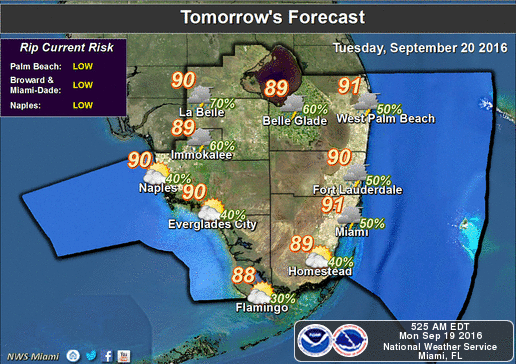 More morning showers and even some early storms are in the forecast for Tuesday, and afternoon storms will be fairly widespread. Tuesday’s highs will be in the upper 80s.
Rain chances will remain on the high side on Wednesday, with afternoon storms popping up. Wednesday’s highs will be in the upper 80s.
Thursday may be the first day of fall, but the weather pattern will be more like summer on both Thursday and Friday. Look for sun and clouds, followed by afternoon storms, especially in the western parts of metro Miami-Dade and Broward, the interior, and the Naples and Marco Island areas. Highs on both days will be in the upper 80s.
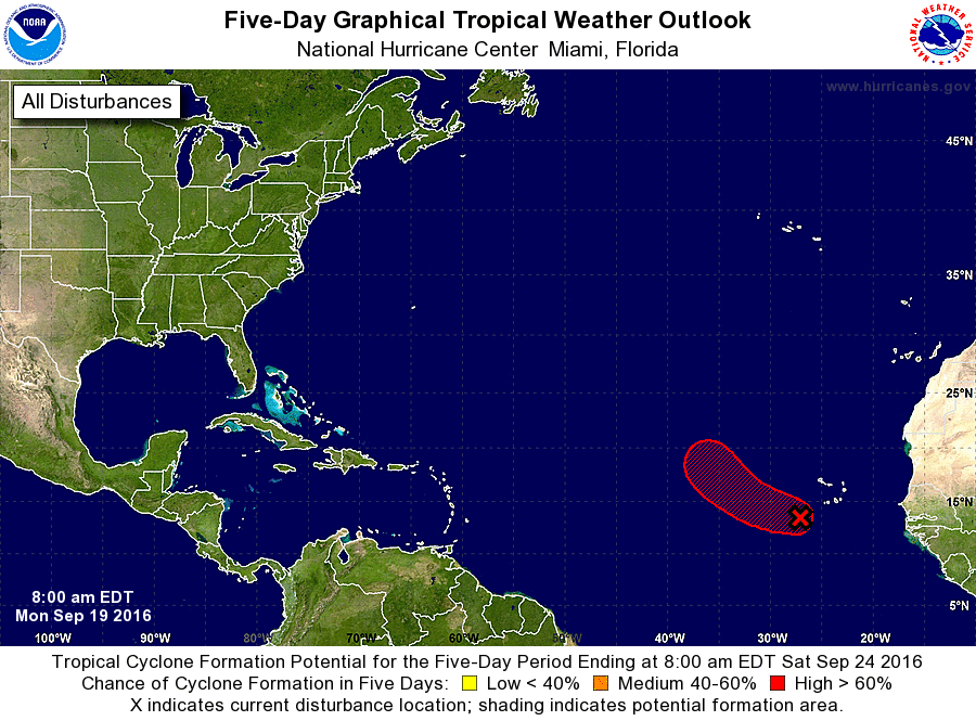 In the tropics, Tropical Storm Karl is forecast to begin strengthening. At 5 am Monday, Karl was located near 18.2 North, 47.7 West, and was moving west at 15 miles per hour. Maximum sustained winds were 40 miles per hour. Karl will eventually move more to the west-northwest and could pose a threat to Bermuda next weekend. Elsewhere, Julia is now a remnant low, and the wave that’s just south of the Cape Verde Islands has a high chance of developing into a depression over the next 5 days.


")


