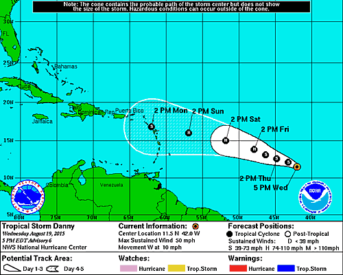
By Donna Thomas, SouthFloridaReporter.com Meteorologist, Aug 19, 2015 – Tropical Storm Danny has been struggling on Wednesday, as dry air has been working its way into the system sooner than anticipated. That’s kept Danny from strengthening, and Danny will face more dry air and increasing wind shear as it moves toward the Leeward Islands. At 5 pm Wednesday, Danny was located near 11.5 North, 42.0 West, and was moving west at 10 miles per hour. Maximum sustained winds were estimated at 50 miles per hour. While the National Hurricane Center forecasts Danny to become a hurricane late Friday or on Saturday, Danny could weaken back to a tropical storm before reaching the islands on Monday. Danny’s circulation could be significantly disrupted by that time, making its future track more uncertain than usual beyond a 5-day timeframe. We’ll need to watch Danny closely over the next several days to see what if any effects it (or its remnants) might have on South Florida or the Bahamas.

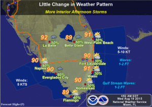
Here in South Florida, we could see a few showers Wednesday night, and some showers will be around early on Thursday. Highs will be in the low 90s, and a few stray storms could pop up inland on Thursday afternoon. Friday will see a few early showers, highs in the low 90s, and a stray afternoon storm or two. The weekend will be muggy, with highs in the low to mid 90s and some afternoon storms. Look for a summertime pattern of afternoon storms and highs in the sticky low to mid 90s as school goes back in session on Monday.


