Home Weather Florida Is Still Sunny And Dry With An Eye On The Tropics

Florida Is Still Sunny And Dry With An Eye On The Tropics

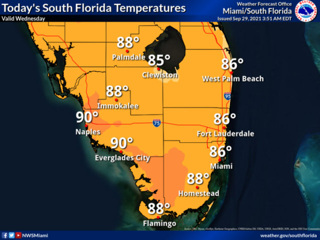
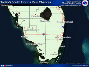
Wednesday features another taste of autumn, South Florida style — lots of sun, low humidity, and just the chance of a stray shower.  A moderate risk of dangerous rip currents remains at the Atlantic beaches.  Highs on Wednesday will be in the upper 80s in the east coast metro area and near 90 degrees along the Gulf coast.

LIVE RADAR 24/7 (Click Here Then Press Play)

Thursday will bring a bit more moisture along with good sun.  A shower or two will be possible during the mid to late afternoon.  Look for a brisk breeze near the Atlantic coast.  Thursday’s highs will be in the upper 80s in the east coast metro area and near 90 degrees along the Gulf coast.

Friday will be sunny in the morning, but some showers and storms will develop during the afternoon.  The east coast metro area will see a gusty ocean breeze.  Friday’s highs will be in the upper 80s in the east coast metro area and the low 90s along the Gulf coast.

Saturday will feature sunny skies and breezy conditions, with some afternoon showers and storms blowing through.  Saturday’s highs will be in the upper 80s in the east coast metro area and near 90 degrees along the Gulf coast.

Sunday’s forecast calls for a mix of sun, showers, and a few storms.  Highs on Sunday will be mostly in the upper 80s.
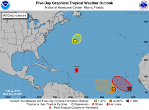
In the tropics, Hurricane Sam continues its slow track through the central Atlantic.  At 5 am, Sam was located near 18.9 North, 56.2 West, about 455 miles east of the northern Leeward Islands.  Maximum sustained winds were 130 miles per hour, and Sam was moving northwest at 9 miles per hour.  There are no watches and warnings at this time, but Sam could track close to Bermuda on Friday into Saturday.

Elsewhere, the remnants of Peter are encountering hostile conditions in the open Atlantic and are not likely to redevelop.  To the south, the wave in the eastern Atlantic has a high chance of becoming a depression during the next five days. The wave approaching the tropical central Atlantic has a medium chance of developing during the next few days, before it’s hindered by that stronger wave to its east.

Donna Thomas has studied hurricanes for two decades. She holds a PhD in history when her experience with Hurricane Andrew ultimately led her to earn a degree in broadcast meteorology from Mississippi State University. Donna spent 15 years at WFOR-TV (CBS4 in Miami-Fort Lauderdale), where she worked as a weather producer with hurricane experts Bryan Norcross and David Bernard. She also produced hurricane specials and weather-related features and news coverage, as well as serving as pool TV producer at the National Hurricane Center during the 2004 and 2005 seasons. Donna also served as a researcher on NOAA's Atlantic Hurricane Database Reanalysis Project. Donna specializes in Florida's hurricane history.