Home Video Dorian Stronger Cat 2, Threat to South Florida Increases (Video) (5am Update)

Dorian Stronger Cat 2, Threat to South Florida Increases (Video) (5am Update)

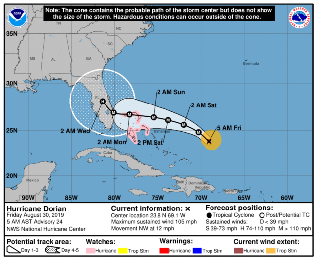
  Hurricane Dorian is stronger early on Friday, and it’s expected to become a major hurricane very soon.  The forecast track has shifted southward, increasing the threat to South Florida.  The northwestern Bahamas are now under a hurricane watch.

At 5 am Friday, Dorian was located near 23.8 North, 69.1 West, about 530 miles east of the northwestern Bahamas.  Dorian was moving northwest at 12 miles per hour.  Maximum sustained winds were 105 miles per hour.  We’ll watch for a turn to the west-northwest and whether Dorian’s intensification will also lead to an expansion of its wind field.
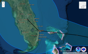
All of South Florida can expect at least tropical storm force winds, beginning in the early hours of Sunday.  Computer models indicate Dorian will slow down near the Florida coast, so its effects are expected to linger through Tuesday.

All of South Florida should plan to take additional storm preparations.  Saturday will be the day to put up shutters and finish last-minute preparations.  We can’t focus on the track alone, because the odds for any portion of South Florida receiving at least hurricane force gusts have increased.  Power outages are likely, so plan accordingly.  It’s still too early to say if evacuations will be ordered, but if you are in an evacuation zone, pay very close attention to what local emergency management officials are saying.
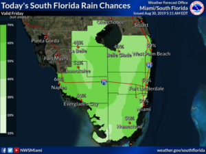
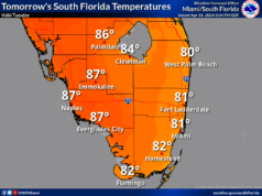
Our weather this weekend and early next week is totally dependent on Dorian.  Friday features lots of clouds and passing showers and storms throughout the day.  Coastal flooding is possible at high tides on Friday into the weekend, and swells from Dorian will make it more pronounced along the east coast.  Highs on Friday will be in the humid and sticky low 90s.

Saturday will be cloudy with periods of showers and storms.  Saturday’s highs will be near 90 degrees.  Local conditions Sunday through Tuesday remain highly uncertain — but expect at least tropical storm force winds, rainfall of 6 to 12 inches, and dangerous storm surge along portions of the east coast.

Views of Hurricane Dorian from the International Space Station earlier Thursday.

[vc_message message_box_style=”solid-icon” message_box_color=”blue”]By Donna Thomas, SouthFloridaReporter.com, certified Meteorologist, Aug. 30, 2019[/vc_message]
Donna Thomas has studied hurricanes for two decades. She holds a PhD in history when her experience with Hurricane Andrew ultimately led her to earn a degree in broadcast meteorology from Mississippi State University. Donna spent 15 years at WFOR-TV (CBS4 in Miami-Fort Lauderdale), where she worked as a weather producer with hurricane experts Bryan Norcross and David Bernard. She also produced hurricane specials and weather-related features and news coverage, as well as serving as pool TV producer at the National Hurricane Center during the 2004 and 2005 seasons. Donna also served as a researcher on NOAA's Atlantic Hurricane Database Reanalysis Project. Donna specializes in Florida's hurricane history.