


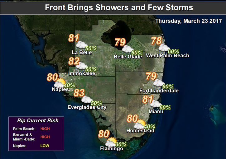
 South Florida’s weather will change quickly on Thursday as a front moves through. After a quiet start to the morning, look for building clouds and passing showers late in the morning and into the afternoon on Thursday. Thursday’s highs will be near 80 degrees. Then winds increase late, and we could see some storms along with the showers. The risk of dangerous rip currents will rapidly increase to high levels on Thursday afternoon and remain high into the weekend.
Showers will linger on Friday, and we’ll see gusty winds bringing in clouds. Friday’s highs will be in the upper 70s.
Saturday features a mix of sun and clouds, along with a few showers on a strong breeze. Highs on Saturday will be near 80 degrees. Look for more sun and fewer clouds on
Sunday, but we can’t rule out a passing shower. Sunday’s highs will be in the low 80s.
Monday’s forecast includes good sun and a few clouds. Highs on Monday will be in the low 80s.


")


