


South Florida will be hot again on Tuesday as we 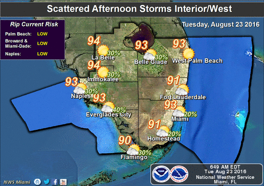 watch the busy tropics. Tuesday features hot sun, a few clouds, and highs mostly in the low 90s, but it will feel about 10 degrees warmer. Some afternoon storms will develop, mostly in the interior, but a stray storm could pop up in the far western suburbs of Miami-Dade and Broward and in the Naples area.
We’ll see higher rain chances and an ocean breeze on Wednesday, with more widespread afternoon storms, especially in the interior. Wednesday’s highs will be around 90 degrees.
Look for scattered afternoon storms around South Florida on Thursday, an increasing risk of dangerous rip currents at the Atlantic beaches, and highs around 90 degrees.
The ocean breeze continues on Friday (along with the risk of rip currents), and some afternoon storms will push past metro Miami-Dade and Broward and move into the interior. Highs will be near 90 degrees on Friday.
We’ll see breezy conditions and passing storms on Saturday as highs reach the low 90s.
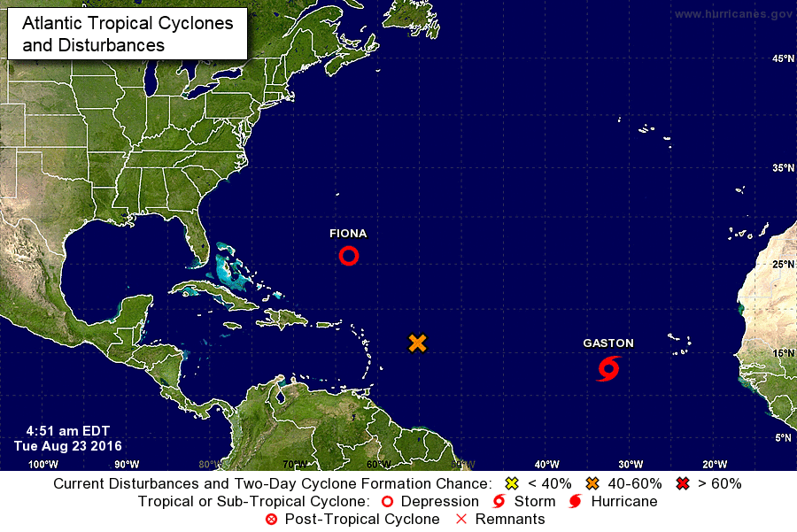 In the tropics, the wave we’ve been watching is approaching the Lesser Antilles and has a medium chance of developing into a depression over the next 5 days. We’re continuing to watch it as it tracks near the Bahamas (and possibly South Florida) this weekend.
Tropical Depression Fiona is hanging on, and the National Hurricane Center’s official forecast still calls for it to dissipate by mid-week. We’ll keep an eye on Fiona, however, because some of the computer models show it tracking toward Florida if it manages to hold together. At 5 pm on Monday, Fiona was located near 25.1 North, 61.3 West, and it was moving west-northwest at 17 miles per hour.
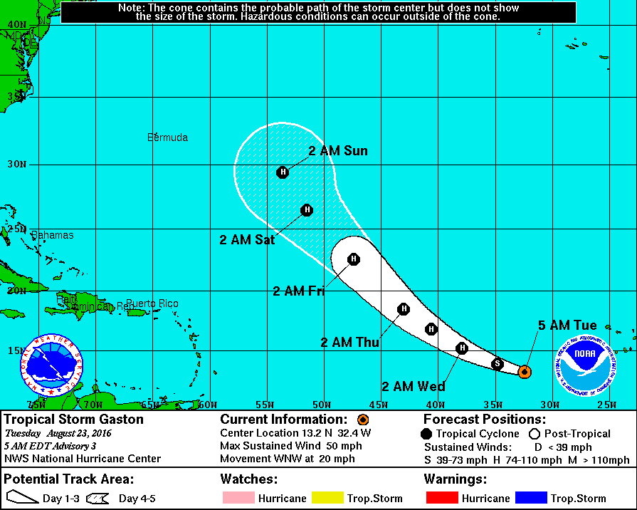 Finally, Tropical Storm Gaston has formed in the eastern Atlantic. At 5 A.M. Tuesday Gaston was located near 13.2 North, 32.4 West, and was moving west-northwest at 20 miles per hour. Maximum sustained winds were estimated at 50 miles per hour, and Gaston is forecast to reach hurricane strength. The good news is that Gaston is forecast to remain over open waters in the Atlantic.


