


South Florida will still be hot on Sunday, but relief of sorts comes soon as we resume our typical summertime pattern. On Sunday, a few early showers (especially in the Keys and southern Miami-Dade) will be followed by a passing shower or two in the afternoon, with any storms remaining well inland. Highs will be in the low 90s and feeling about 10 degrees hotter.
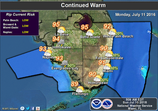 We’ll return to our usual summertime pattern of morning coastal showers, highs near the 90 degree mark, and a few afternoon showers and maybe a storm on Monday.
Rain chances go up slightly on Tuesday and Wednesday as highs remain around 90 degrees.
The chance of showers and storms decreases a bit on Thursday, with highs around 90 degrees again.


