Home Weather Tracking Hurricane Matthew; Rain Here Sunday

Tracking Hurricane Matthew; Rain Here Sunday

hurricane matthew

hurricane matthewSouth Florida is on watch for the future course of Hurricane Matthew, the most powerful Caribbean hurricane in years.

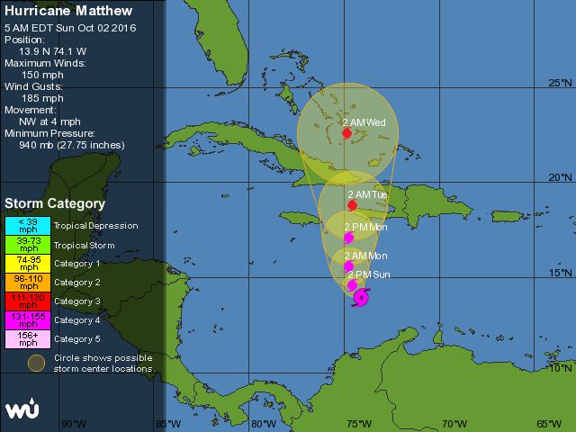
Matthew remains a powerful and dangerous hurricane. At 5 am Sunday, it was located near 13.9 North, 74.1 West, about 335 miles south-southeast of Kingston, Jamaica. Maximum sustained winds were 150 miles per hour, and Matthew was moving northwest at 5 miles per hour.
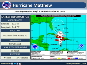
hurricane matthewHurricane warnings are in effect for Jamaica and much of Haiti, and additional watches are in effect for parts of Cuba, the Dominican Republic, and the southeastern Bahamas. We’re watching Matthew’s track on Sunday for a northward turn.

The hurricane’s worst impacts are likely to be felt in Haiti, where heavy rains could lead to catastrophic flooding and mudslides. While Jamaica will experience damaging winds, the core of Matthew is expected to remain offshore. Matthew is forecast to reach eastern Cuba and Haiti early Tuesday and move slowly northward through the Bahamas on Tuesday, Wednesday, and early Thursday.

Closest approach to South Florida should be early Thursday. The Bahamas will experience hurricane conditions, so everyone there should prepare. While we’re feeling a bit better regarding South Florida, we need to pay very close attention to Matthew’s track — because a slight change further west could mean we’ll need to prepare for at least tropical storm conditions here.
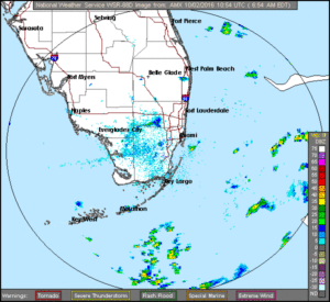
hurricane matthewOur Sunday features early showers and storms in the east coast and in the Keys, then afternoon storms developing around the area, with much of the activity in the western suburbs of Miami-Dade and Broward, in the interior, and along the Gulf coast. Highs will be mostly in the upper 80s in the east, and around 90 degrees in Naples and Marco Island.

Monday will be breezy, especially along the east coast and in the Upper Keys, and the risk of dangerous rip currents will increase and remain elevated throughout the week. Look for storms to pop up around South Florida on Monday afternoon, and highs will be in the upper 80s.

Tuesday will be windy and showers and storms will blow through as Matthew moves to southeast. Highs will be in the mid to upper 80s.

Windy conditions, passing showers and storms, and highs in the mid to upper 80s are in Wednesday’s forecast in South Florida as Matthew moves slowly northward through the Bahamas.

[vc_message message_box_style=”3d” message_box_color=”turquoise”]By Donna Thomas, SouthFloridaReporter.com Meteorologist, Oct. 2, 2016[/vc_message]
Donna Thomas has studied hurricanes for two decades. She holds a PhD in history when her experience with Hurricane Andrew ultimately led her to earn a degree in broadcast meteorology from Mississippi State University. Donna spent 15 years at WFOR-TV (CBS4 in Miami-Fort Lauderdale), where she worked as a weather producer with hurricane experts Bryan Norcross and David Bernard. She also produced hurricane specials and weather-related features and news coverage, as well as serving as pool TV producer at the National Hurricane Center during the 2004 and 2005 seasons. Donna also served as a researcher on NOAA's Atlantic Hurricane Database Reanalysis Project. Donna specializes in Florida's hurricane history.