Home Weather Steamy Friday, Tropics Heat Up

Steamy Friday, Tropics Heat Up

steamy september

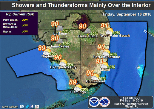
South Florida will be steamy Friday as our typical September weather pattern continues. Look for a stray morning shower along the east coast and in the Keys, followed by sun and clouds, highs near 90 degrees (but on the sticky side), and a few mostly inland afternoon storms.
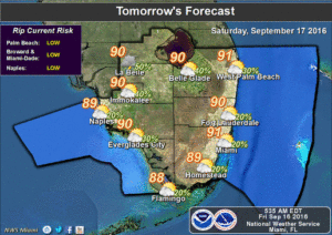
steamy fridayThe weekend features sun and clouds, a stray storm well inland from both the Atlantic and Gulf coasts, and highs in the steamy low 90s.

We’ll see a few early east coast showers on Monday, sun and clouds, highs around the 90 degree mark, and a few passing afternoon storms, mostly in the interior.

Tuesday will bring a few early showers, periods of sun, highs around 90 degrees, and scattered storms in the western suburbs of Miami-Dade and Broward, the interior, and the Naples and Marco Island areas.
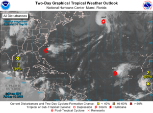
steamy fridayIn the tropics, Julia is back to tropical storm status and is hovering well off the Carolina coast. At 5 am Friday, Tropical Storm Julia was located near 31.1. North, 76.4 West, and was moving southeast at 5 miles per hour. Julia’s maximum sustained winds were 40 miles per hour. It will wander off the coast and eventually dissipate.

In the far Atlantic, Tropical Storm Karl is moving west at 13 miles per hour. At 5 am Friday, Karl was located near 18.3 North, 33.4 West, and had top winds estimated at 45 miles per hour. We’ll watch it as it approaches the central Atlantic.

Elsewhere, Tropical Storm Ian is racing northeast at 48 miles per hour and is transitioning to post-tropical cyclone status. The area of showers in the northwestern Gulf of Mexico has a low chance of developing as it moves toward the Texas coast over the next several days. And finally, a wave emerging off the coast of Africa has a medium chance of becoming a depression over the next 5 days. It is expected to remain in the central Atlantic.

[vc_message message_box_style=”3d” message_box_color=”turquoise”]By Donna Thomas, SouthFloridaReporter.com Meteorologist, Sept. 16, 2016 [/vc_message]
Donna Thomas has studied hurricanes for two decades. She holds a PhD in history when her experience with Hurricane Andrew ultimately led her to earn a degree in broadcast meteorology from Mississippi State University. Donna spent 15 years at WFOR-TV (CBS4 in Miami-Fort Lauderdale), where she worked as a weather producer with hurricane experts Bryan Norcross and David Bernard. She also produced hurricane specials and weather-related features and news coverage, as well as serving as pool TV producer at the National Hurricane Center during the 2004 and 2005 seasons. Donna also served as a researcher on NOAA's Atlantic Hurricane Database Reanalysis Project. Donna specializes in Florida's hurricane history.