


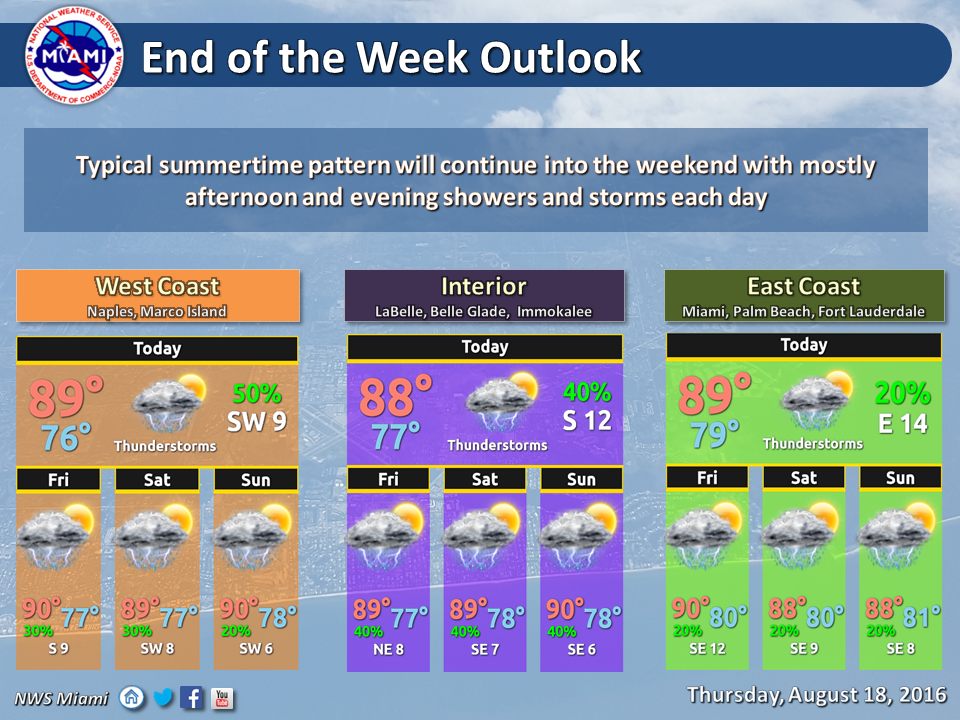
 South Florida will start Thursday with a round of showers, but the widespread activity we’ve seen in the last few days. Quick-moving early showers will affect portions Miami-Dade, Broward, and the Keys. With Thursday’s highs mostly in the low 90s, we’ll see a few afternoon storms develop, especially in the far western suburbs of Miami-Dade and Broward, interior regions, and along the Gulf coast.
We can’t rule out a few early morning showers along the east coast on Friday, but our pattern is now shifting to mainly afternoon storms. Friday features sun, clouds, highs in the low 90s, and scattered afternoon storms, mostly in the interior regions of South Florida.
Saturday will bring sun and clouds, highs in the low 90s, and a few afternoon storms forming along the sea breezes of both coasts — with storms most likely to pop up in the western suburbs of Miami-Dade and Broward, the interior, and several miles east of the Gulf coast.
Sunday will be a repeat, with a mostly dry morning, sun and clouds, highs in the low 90s, and a few afternoon storms forming away from the immediate coasts and in the interior.
Look for the pattern of scattered afternoon storms forming on the sea breezes to continue on Monday, as highs again reach the low 90s.
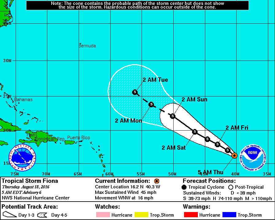 In the tropics, Tropical Depression # 6 has been upgraded to Tropical Storm Fiona. At 5 am Thursday, Fiona was located near 16.2 North, 40.3 West, and had maximum sustained winds estimated at 45 miles per hour. Fiona was moving west-northwest at 16 miles per hour. It will battle drier air for the next few days, which is expected to limit development. Most of the computer models show Fiona eventually making a turn to the northwest and north, away from the U.S. coast. Bermuda, however, will need to watch the course of this system.


")


