Home Weather Sun Gives Way To More Showers And Storms Today; Tracking The Tropics

Sun Gives Way To More Showers And Storms Today; Tracking The Tropics

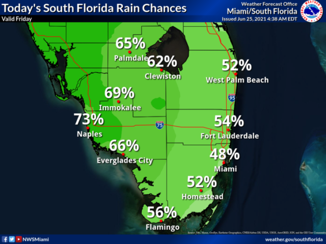
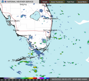
Friday features periods of sun and clouds along with periods of showers and storms.  Localized flooding is possible in spots.  Highs on Friday will be in the upper 80s.

LIVE RADAR 24/7 (Click Here Then Press Play)

Saturday will bring a mix of sun and clouds with widespread showers and storms.  A sometimes gusty ocean breeze will increase the risk of dangerous rip currents at the Atlantic beaches this weekend.  Saturday’s highs will be in the upper 80s in the east coast metro area and the low 90s along the Gulf coast.

Sunday will continue our stretch of unsettled weather.  Look for some sun but more clouds, showers, and storms.  Sunday’s highs will be in the upper 80s.

Monday will feature a mix of sun and clouds with periods of showers and storms again.  Monday’s highs will be in the upper 80s.

Tuesday’s forecast calls for another summer day of widespread showers and storms.  Highs on Tuesday will be in the upper 80s again.
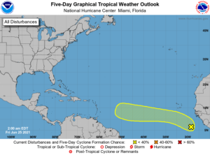
In the tropics, we’re watching a wave in the eastern Atlantic that has a low chance of developing during the next 5 days.

Donna Thomas has studied hurricanes for two decades. She holds a PhD in history when her experience with Hurricane Andrew ultimately led her to earn a degree in broadcast meteorology from Mississippi State University. Donna spent 15 years at WFOR-TV (CBS4 in Miami-Fort Lauderdale), where she worked as a weather producer with hurricane experts Bryan Norcross and David Bernard. She also produced hurricane specials and weather-related features and news coverage, as well as serving as pool TV producer at the National Hurricane Center during the 2004 and 2005 seasons. Donna also served as a researcher on NOAA's Atlantic Hurricane Database Reanalysis Project. Donna specializes in Florida's hurricane history.