


South Florida will see showers, storms, clouds on Tuesday as we continue to watch the tropics. After some early east coast showers, look for afternoon storms popping up around the area, with much of the activity in the western suburbs of Miami-Dade and Broward, in the interior, and along the Gulf coast. Tuesday’s highs will be in the upper 80s.
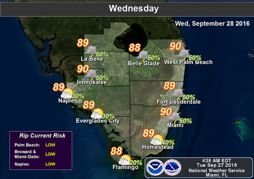 More showers and storms will be around on Wednesday, and highs will be in the upper 80s.
Rain chances go down slightly on Thursday, and most of the afternoon storms will develop in the interior. Thursday’s highs will be near 90 degrees.
More afternoon storms will pop up on Friday, especially in the western part of metro Miami-Dade and Broward and in the interior. Highs on Friday will be near 90 degrees.
Saturday features a few early east coast showers, afternoon storms well inland, and highs in the upper 80s.
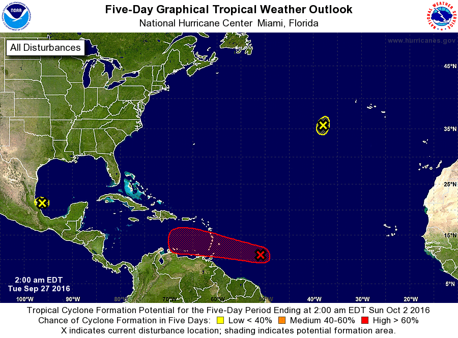 The wave we’ve been watching is more organized and stronger as it moves toward the Windward Islands. It could reach tropical depression or tropical storm status before it reaches the islands on Wednesday. It will move generally to the west over the next few days into an area where conditions are favorable for further strengthening. The models are not in agreement after two to three days, and some of them do indicate a northward turn. We’ll continue to watch this system closely.
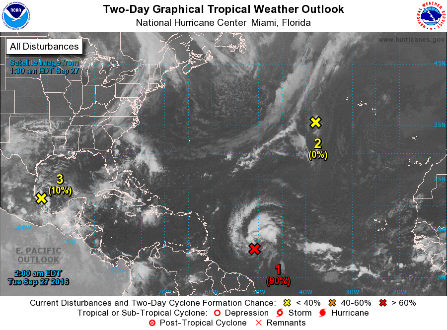 Elsewhere in the tropics, an area of disturbed weather in the far southwestern Gulf of Mexico has a low chance of development. The National Hurricane Center is also watching the remnants of Lisa in the central Atlantic, but these have virtually no chance of development.
[vc_message message_box_style=”3d” message_box_color=”turquoise”]By Donna Thomas, SouthFloridaReporter.com Meteorologist, Sept. 27, 2016 [/vc_message]


")


