Home Weather Showers And Storms Are Back In Florida; Tracking The Busy Tropics

Showers And Storms Are Back In Florida; Tracking The Busy Tropics

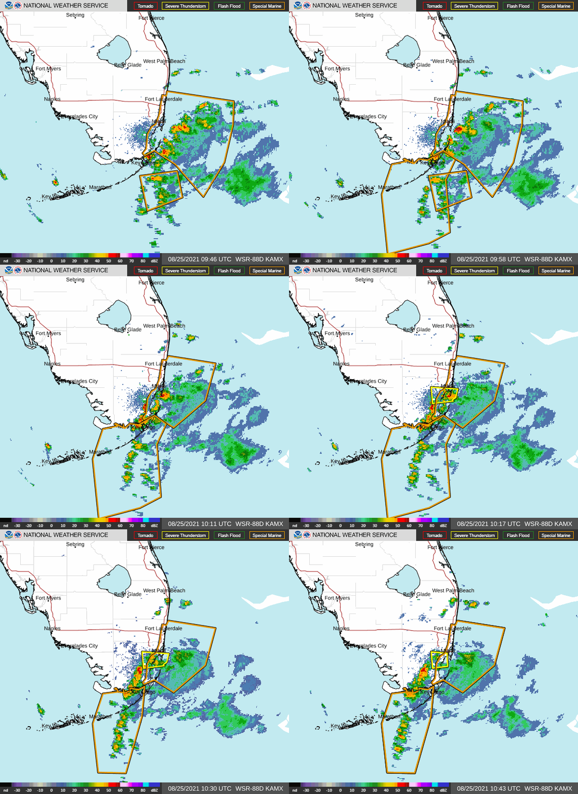
A line of strong showers and thunderstorms is currently moving across our southern Atlantic waters. Strong wind gusts and frequent lightning are possible with this activity.
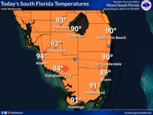
Wednesday features hot sun with periods of showers and storms.   A brisk breeze is in place in the east coast metro area, and it’s bringing in some strong storms on Wednesday morning.  A high risk of dangerous rip currents at the Atlantic beaches through at least Thursday. Highs on Wednesday will be in the low 90s.

LIVE RADAR 24/7 (Click Here Then Press Play)

Thursday will bring sun alternating with showers and storms — starting in the morning in the east coast metro area and in the mid-afternoon along the Gulf coast.  Thursday’s highs will be in the upper 80s right at the Atlantic coast and the low 90s elsewhere.

Friday will feature good sun in the morning and some showers and storms during the mid to late afternoon.  Friday’s highs will be in the low 90s.

Saturday will be another day of early sun and periods of showers and storms in the mid to late afternoon.  Saturday’s highs will be in the low 90s.

Sunday’s forecast calls for mostly sunny skies alternating with periods of showers and storms.  Highs on Sunday will be in the low 90s again.
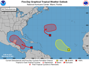
In the tropics, we’re keeping an eye on three waves that all have a chance of developing into our next depression.  The first is in the central Atlantic, and it has a high chance of developing.  Another wave, this one in the eastern Atlantic, has a low chance of developing during the next five days.  But we’ll keep a closer watch on the wave approaching the central Caribbean.  It has a high chance of developing and is expected to affect portions of Central America and enter the southwestern Gulf of Mexico.

Donna Thomas has studied hurricanes for two decades. She holds a PhD in history when her experience with Hurricane Andrew ultimately led her to earn a degree in broadcast meteorology from Mississippi State University. Donna spent 15 years at WFOR-TV (CBS4 in Miami-Fort Lauderdale), where she worked as a weather producer with hurricane experts Bryan Norcross and David Bernard. She also produced hurricane specials and weather-related features and news coverage, as well as serving as pool TV producer at the National Hurricane Center during the 2004 and 2005 seasons. Donna also served as a researcher on NOAA's Atlantic Hurricane Database Reanalysis Project. Donna specializes in Florida's hurricane history.