Home Weather Cloudy Start For Florida Then Clearing And Becoming Cooler

Cloudy Start For Florida Then Clearing And Becoming Cooler

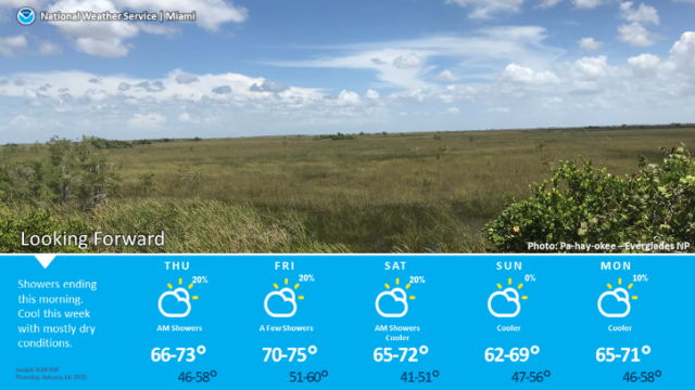
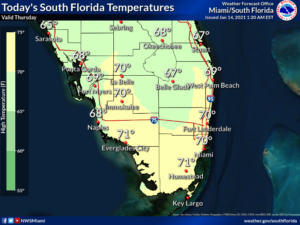
Thursday features lots of clouds and some early showers, but we’ll see more sun as the front clears our area later.  A moderate risk of dangerous rip currents remains along the Palm Beach County coast.  Highs on Thursday will be in the low 70s.

LIVE RADAR 24/7 (Click Here Then Press Play)

Friday will bring a mix of sun and clouds with some passing showers, mostly in the afternoon.  Friday’s highs will be in the low 70s.

Saturday will be breezy along the Gulf coast.  Look for a mix of sun and clouds around South Florida.  Saturday’s highs will be in the upper 60s along the Gulf Coast and near 70 degrees in the east coast metro area.

Sunday morning will be chilly, with lows in the upper 40s and low 50s.  The day will be partly sunny and cool.  Sunday’s highs will be in the mid-60s.

Martin Luther King Day will feature clouds and showers.  Highs on Monday will be near 70 degrees.

Donna Thomas has studied hurricanes for two decades. She holds a PhD in history when her experience with Hurricane Andrew ultimately led her to earn a degree in broadcast meteorology from Mississippi State University. Donna spent 15 years at WFOR-TV (CBS4 in Miami-Fort Lauderdale), where she worked as a weather producer with hurricane experts Bryan Norcross and David Bernard. She also produced hurricane specials and weather-related features and news coverage, as well as serving as pool TV producer at the National Hurricane Center during the 2004 and 2005 seasons. Donna also served as a researcher on NOAA's Atlantic Hurricane Database Reanalysis Project. Donna specializes in Florida's hurricane history.