


South Florida is baking in typical August heat on Sunday while the tropics heat up. Look for a stray east coast shower on Sunday morning, with plenty of sun, highs in the sizzling low to mid 90s, and a few isolated afternoon storms to follow. The storms will be mostly in the interior, but don’t rule out one or two developing in the far western suburbs of Miami-Dade and Broward.
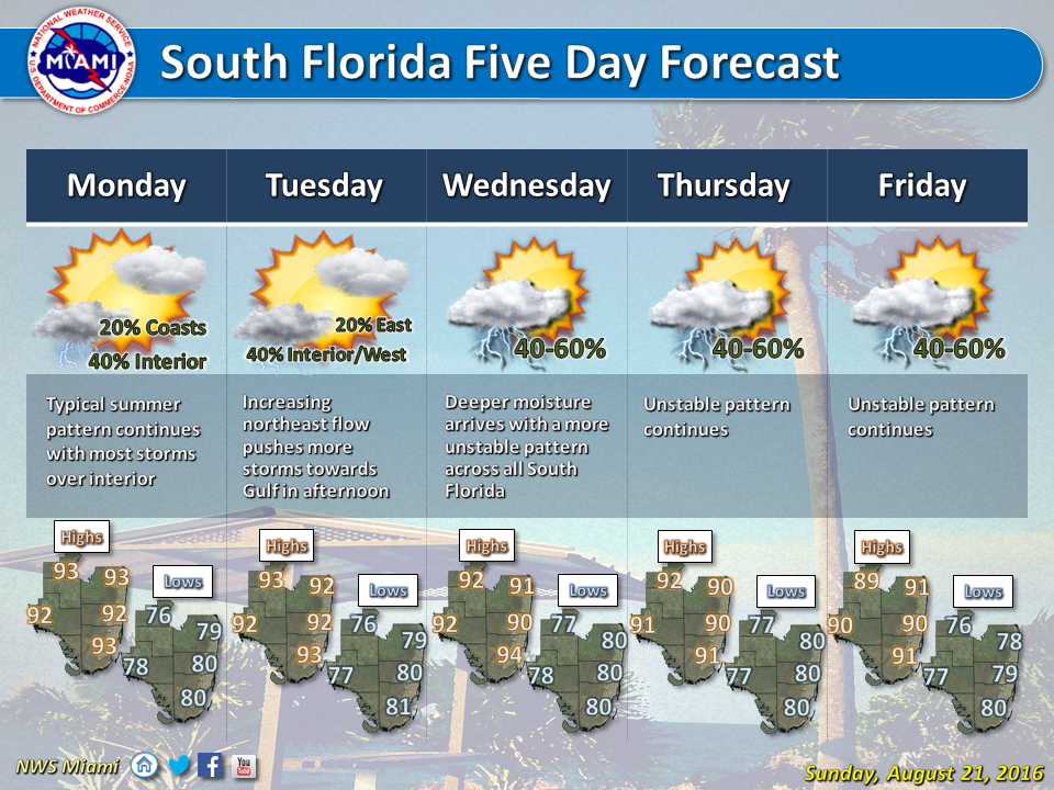 Monday features an early shower along the east coast, highs in the low 90s, and a few afternoon storms forming along the sea breezes of both coasts, so scattered afternoon storms are in the forecast for the metro areas of Miami-Dade and Broward and the Naples area. Those storms will push into the interior late in the afternoon and in the evening.
We’ll see more of the same on Tuesday, with highs in the low 90s and the sea breezes bringing a few afternoon storms to South Florida’s east coast and west coast metro areas.
Afternoon storms will be more widespread on Wednesday, especially in the western suburbs of Miami-Dade and Broward, in the interior, and along the Gulf coast. Highs on Wednesday will be in the low 90s.
Look for scattered afternoon storms again on Thursday, with a concentration over the interior and the Gulf coast. Highs will be around 90 degrees on Thursday.
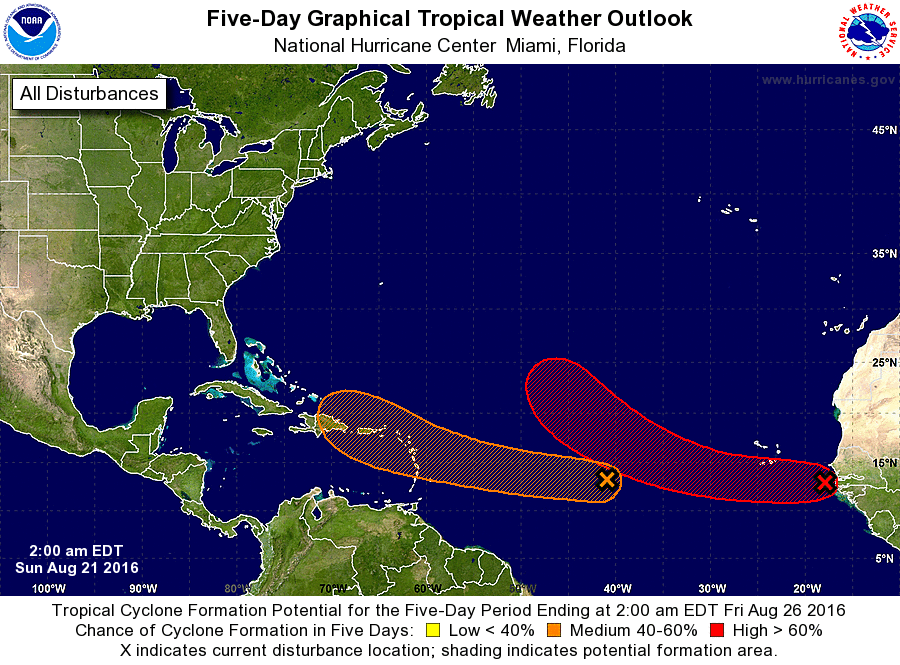 In the tropics, we’re watching the wave that’s nearing the central Atlantic. It has a medium chance of developing over the next 5 days, when it is forecast to be in the general vicinity of Puerto Rico. The wave will be encountering favorable conditions, and some of the computer models forecast a path near the Bahamas this weekend. Everyone will need to watch this system closely.
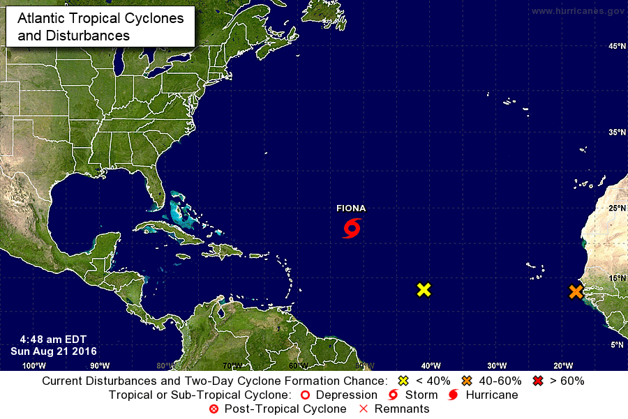 Elsewhere, Tropical Storm Fiona is stubbornly hanging on, with top winds of 45 miles per hour at 5 am on Sunday, when Fiona was located near 22.2 North, 51.7 West. Fiona was moving west-northwest at 16 miles per hour and is forecast to weaken into a depression on Sunday and dissipate by mid-week.
And a wave just off the African coast has a high chance of developing over the next 5 days. That one is forecast to remain over the open Atlantic.


")


