


It’s August in South Florida, and the heat and storms have settled in this weekend. After some early showers, Saturday features some afternoon storms, especially inland, and highs in the sticky low 90s.
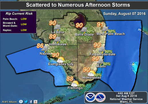 A few early showers appear on Sunday, followed by building clouds and fairly widespread afternoon storms that could last into the evening. Sunday’s highs will be mostly in the muggy low 90s, but a few locations could reach the mid 90s.
Monday brings some early coastal showers, afternoon storms, and highs in the sticky low 90s.
Some showers will be on the breeze on Tuesday, and afternoon storms will follow as highs reach the low 90s again.
We’ll be in this pattern again on Wednesday — early showers, afternoon storms, and highs in the seasonably sticky low 90s.
In the tropics, Tropical Storm Earl continues to dump heavy rain over Mexico. At 5 am Saturday, Earl was located near 19.0 North, 97.0 West, or about 55 miles from Veracruz. Earl was moving west at 10 miles per hour and had maximum sustained winds of 40 miles per hour. Earl’s greatest threats are flash floods and mudslides before it finally dissipates this weekend.
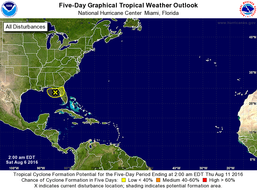 Elsewhere, an area of disturbed weather off Florida’s Big Bend will bring plenty of rain to portions of the Gulf coast. The National Hurricane Center gives the disturbance a low chance of developing over the next 5 days as it stalls in the northeast Gulf of Mexico.


