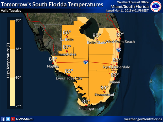
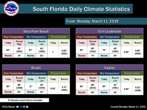
Monday was another warm day across South Florida, but we remained a few degrees below any records. Similar weather continues into Tuesday, but with a few more Atlantic showers late day as a weak front arrives into the region.
South Florida will be warm and mostly dry again on Tuesday. After some early fog along the Gulf coast and well inland, the day features good sun and some clouds. Highs on Tuesday will be in the mid 80s.
Some east coast showers are in the forecast for Wednesday, and then we’ll see plenty of clouds as a weak front dissipates near us. Wednesday’s highs will be in the low 80s.
Look for a mix of sun and clouds with breezy conditions on Thursday. Thursday’s highs will be in the low 80s.
Friday will bring plenty of sun and a few clouds. Dangerous rip currents will again be a threat at the Atlantic beaches on Friday and into the weekend. Friday’s highs will be in the low to mid 80s.
Saturday will feature lots of sun and blue skies. Highs on Saturday will be mostly in the mid 80s.
Disclaimer
The information contained in South Florida Reporter is for general information purposes only.
The South Florida Reporter assumes no responsibility for errors or omissions in the contents of the Service.
In no event shall the South Florida Reporter be liable for any special, direct, indirect, consequential, or incidental damages or any damages whatsoever, whether in an action of contract, negligence or other tort, arising out of or in connection with the use of the Service or the contents of the Service. The Company reserves the right to make additions, deletions, or modifications to the contents of the Service at any time without prior notice.
The Company does not warrant that the Service is free of viruses or other harmful components