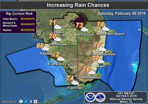
South Florida is off to a cool start on Saturday morning, but the day will finish with plenty of rain.
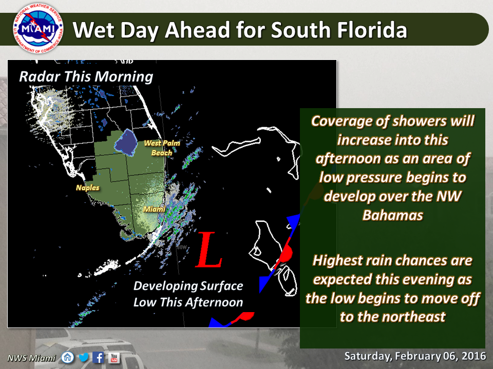
Look for some sun, followed by building clouds, highs in the mid 70s, and then increasing showers as that stalled out front to our south moves back over South Florida and develops into a low. Some showers will linger into the overnight hours before the system sweeps out, allowing much colder air to move in.
Sunday will be cloudy, breezy, damp, and chilly, with highs in the mid 60s.
Monday morning will be downright cold, with lows in the mid to upper 40s in most locations. Even with a return of the sun, temperatures will just reach the mid 60s on Monday.
Tuesday will be a little warmer, with highs near 70 degrees, but then more cold air moves in, with Wednesday’s highs back in the mid to upper 60s.
A slow warming trend begins on Thursday, but with highs in the low 70s, we’ll still be below normal for mid February.
By Donna Thomas, SouthFloridaReporter.com Meteorologist, Feb. 6, 2016
[/vc_message]Disclaimer
The information contained in South Florida Reporter is for general information purposes only.
The South Florida Reporter assumes no responsibility for errors or omissions in the contents of the Service.
In no event shall the South Florida Reporter be liable for any special, direct, indirect, consequential, or incidental damages or any damages whatsoever, whether in an action of contract, negligence or other tort, arising out of or in connection with the use of the Service or the contents of the Service. The Company reserves the right to make additions, deletions, or modifications to the contents of the Service at any time without prior notice.
The Company does not warrant that the Service is free of viruses or other harmful components