Home Weather Thurs UPDATE #2: Hurricane Dorian On The Move

Thurs UPDATE #2: Hurricane Dorian On The Move

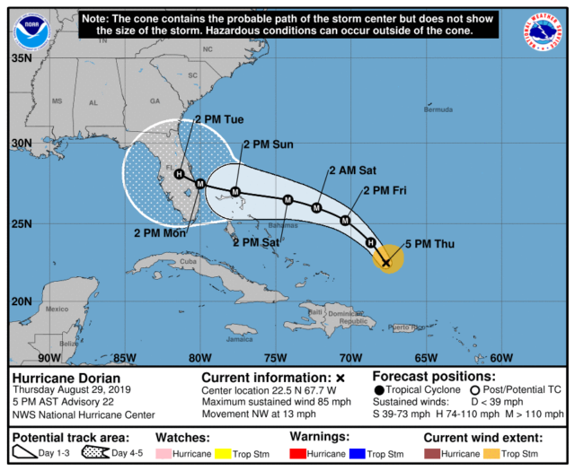
  Hurricane Dorian hasn’t really changed through 5 pm Thursday.  Maximum sustained winds remain at 85 miles per hour, and Dorian continues to move to the northwest at 13 miles per hour.  At 5 pm, it was located near 22.5 North, 67.7 West, about 330 miles east of the southeastern Bahamas.  Dorian has been undergoing some eye wall fluctuation, which is not out of the ordinary.
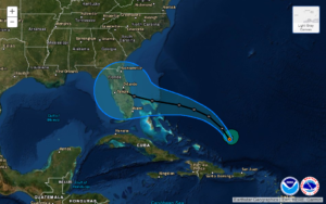
Dorian is expected to intensify, and the models indicate it will be a category 4 hurricane at landfall.  The computer models are not in agreement on the track beyond 3 days, so the 4-to-5 day cone remains enormous.  We still can’t narrow down the area where landfall is likely to occur.

The models also indicate that Dorian will eventually slow down.  That could effect when Dorian makes its turn to the west-northwest, because the models are not in agreement as to when the ridge that will push Dorian to the west-northwest will build in.  And all of that will have a major impact on what portion of the Florida coast will get the greatest impact from Dorian — and when.

This is probably going to be a nail-biter.  We’ll just have to continue our common-sense hurricane preparations until we have some answers, probably sometime on Friday.  Then we can put up shutters on Saturday, if that becomes necessary.  Above all, stay informed, because Dorian’s future track is far from certain.

[vc_message message_box_style=”solid-icon” message_box_color=”blue”]By Donna Thomas, SouthFloridaReporter.com, certified Meteorologist, Aug. 29, 2019 [/vc_message]
Donna Thomas has studied hurricanes for two decades. She holds a PhD in history when her experience with Hurricane Andrew ultimately led her to earn a degree in broadcast meteorology from Mississippi State University. Donna spent 15 years at WFOR-TV (CBS4 in Miami-Fort Lauderdale), where she worked as a weather producer with hurricane experts Bryan Norcross and David Bernard. She also produced hurricane specials and weather-related features and news coverage, as well as serving as pool TV producer at the National Hurricane Center during the 2004 and 2005 seasons. Donna also served as a researcher on NOAA's Atlantic Hurricane Database Reanalysis Project. Donna specializes in Florida's hurricane history.