Home Weather Some Sun Today, But Watching the Tropics This Weekend

Some Sun Today, But Watching the Tropics This Weekend

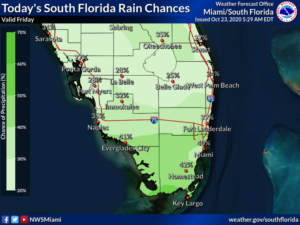
Friday features mostly sunny skies alternating with scattered showers in the morning.  Look for more showers and a few storms on a gusty breeze in the afternoon.  A high risk of dangerous rip currents is in place at the Atlantic beaches at least through the evening.  Some flooding at high tide is possible in the Upper Keys.  Highs on Friday will be in the mid-80s in the east coast metro area and the upper 80s along the Gulf coast.

LIVE RADAR 24/7 (Click Here Then Press Play)

Saturday will bring sun and clouds in the morning with periods of showers and storms in the afternoon and evening.  Saturday’s highs will be in the mid-80s in the east coast metro area and the upper 80s along the Gulf coast.

Sunday’s weather will depend on the track and strength of that low in the western Caribbean that we’ve been watching.  For now, we’ll say that Sunday will see breezy conditions, plenty of clouds, and widespread showers and storms.  Sunday’s highs will be in the mid-80s.

Monday will feature some sun, more clouds, and showers and storms at times.  Monday’s highs will be in the 80s.

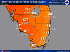
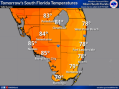
Tuesday’s forecast calls for lots of sun and a shower or two in spots.  Highs on Tuesday will be in the upper 80s.
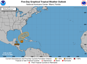
In the tropics, the low in the western Caribbean is centered near the Cayman Islands early on Friday.  It’s forecast to move over Cuba and the Florida Straights on Saturday and be in or near the Bahamas on Sunday.  While the National Hurricane Center gives this feature a medium chance of becoming a depression, we’ll need to watch it carefully.  Its main threat will be plenty of rain over the weekend and into Monday, so the potential of localized flooding is high.

Elsewhere, Hurricane Epsilon is moving away from Bermuda.  At 5 am Friday, Epsilon was located near 33.1 North, 61.6 West, about 195 miles east-northeast of Bermuda.  Maximum sustained winds were 85 miles per hour.  Epsilon was moving north at 7 miles per hour.


Donna Thomas has studied hurricanes for two decades. She holds a PhD in history when her experience with Hurricane Andrew ultimately led her to earn a degree in broadcast meteorology from Mississippi State University. Donna spent 15 years at WFOR-TV (CBS4 in Miami-Fort Lauderdale), where she worked as a weather producer with hurricane experts Bryan Norcross and David Bernard. She also produced hurricane specials and weather-related features and news coverage, as well as serving as pool TV producer at the National Hurricane Center during the 2004 and 2005 seasons. Donna also served as a researcher on NOAA's Atlantic Hurricane Database Reanalysis Project. Donna specializes in Florida's hurricane history.