


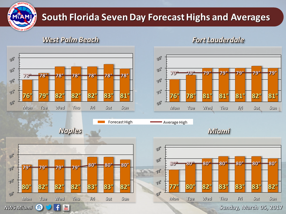
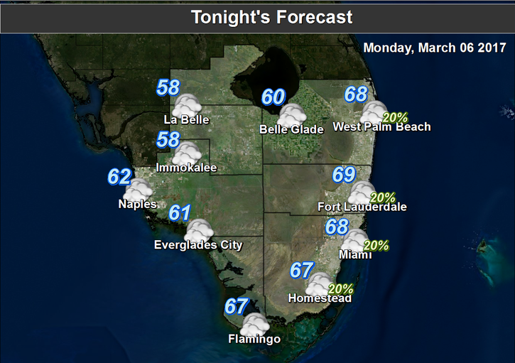
 South Florida will see another day of strong breezes and scattered showers on Monday. After a mild morning, look for breezy conditions (including gusty periods when winds could reach 35 miles per hour) and lots of clouds. Some showers will blow through in spots. The risk of dangerous rip currents remains high at the Atlantic beaches on Monday and is expected to stay at that level at least through Wednesday morning. Highs on Monday will be mostly in the upper 70s, but some coastal locations may not make it out of the mid 70s.
Tuesday will be breezy again, and some showers will blow by along with plenty of clouds. Highs on Tuesday will be near 80 degrees.
Wednesday features a mix of sun and clouds throughout the day, and afternoon highs will be in the low 80s. Then showers and clouds build as a weak front moves in late on Wednesday and overnight.
Thursday will see a few lingering showers early, followed by drier conditions and a mix of sun and clouds. Highs on Thursday will be near the 80 degree mark.
Look for good sun and a few clouds on Friday. Friday’s highs will be in the low 80s.


