Home Weather Storms Around Florida, Some Could Be Strong

Storms Around Florida, Some Could Be Strong

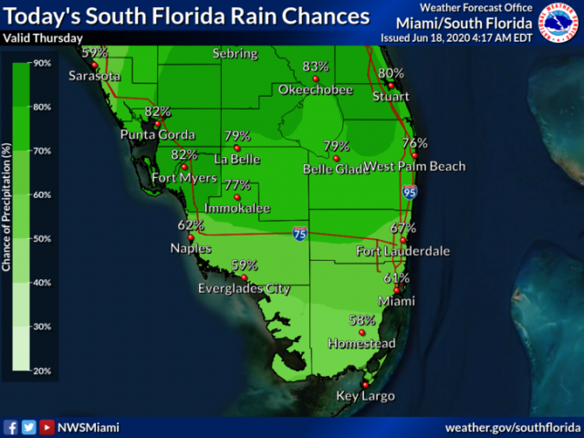
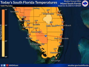
Thursday features showers, storms, and lots of clouds.  Slow-moving storms could lead to dangerous street flooding in some locations.  We could also see some strong storms, bringing not just heavy rainfall but dangerous lightning and damaging winds.  Highs on Thursday will be in the upper 80s.

LIVE RADAR 24/7 (Click Here Then Press Play)

After overnight showers and storms, Friday will be another day of showers and storms bringing heavy rain at times.  Street flooding from slow-moving storms is possible once again.  Friday’s highs will be in the upper 80s.

Saturday will see a return of the sun, but clouds, showers, and storms will build in the afternoon.  Saturday’s highs will be near 90 degrees.

Fathers Day will feature good sun in the morning and early afternoon, followed by showers and storms developing later in the day.  Sunday’s highs will be near 90 degrees.

Monday’s forecast includes a typical summertime mix of sun, clouds, showers, and storms.  Highs on Monday will be in the low 90s.

In the tropics, we’re not expecting any development during the next few days.

Donna Thomas has studied hurricanes for two decades. She holds a PhD in history when her experience with Hurricane Andrew ultimately led her to earn a degree in broadcast meteorology from Mississippi State University. Donna spent 15 years at WFOR-TV (CBS4 in Miami-Fort Lauderdale), where she worked as a weather producer with hurricane experts Bryan Norcross and David Bernard. She also produced hurricane specials and weather-related features and news coverage, as well as serving as pool TV producer at the National Hurricane Center during the 2004 and 2005 seasons. Donna also served as a researcher on NOAA's Atlantic Hurricane Database Reanalysis Project. Donna specializes in Florida's hurricane history.