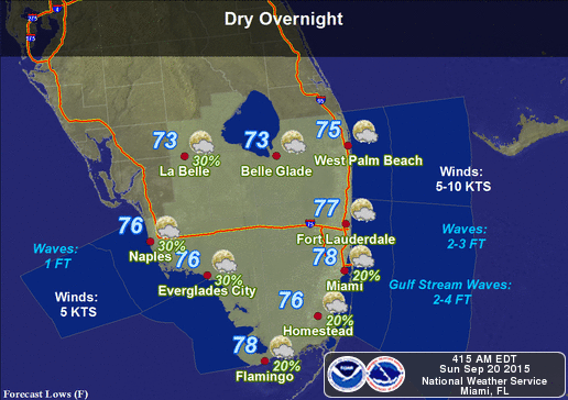
By Donna Thomas, SouthFloridaReporter.com Meteorologist, Sept. 20, 2015 – South Florida will see a few passing showers on Sunday, along with summertime heat. Look for early showers in spots, followed by sun and clouds, highs in the low 90s, and a chance of a stray storm in the western suburbs.
The workweek will begin with morning showers on an ocean breeze, just a chance of an afternoon storm, and highs near 90 degrees on Monday, with the pattern extending into Wednesday. Rain chances will go up on Thursday and Friday, with temperatures topping out near 90 degrees.
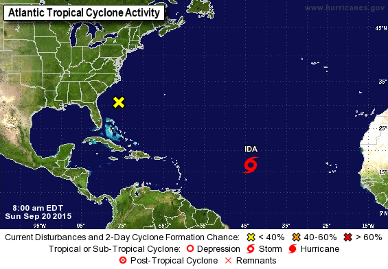
Tropical Storm Ida is now the only system we’re watching, with Tropical Depression #9 degenerating into a remnant low and the low off the northeast Florida coast having only a low chance of developing. At 5 am Sunday, Ida was located near 16.7 North, 43.6 West, and was moving west-northwest at 15 miles per hour. Maximum sustained winds were 40 miles per hour, but Ida is expected to strengthen as wind shear decreases over the system during the next few days. Ida is forecast to stall out by the middle of the week, and computer models continue to be split on Ida’s future track beyond the next few days.


