


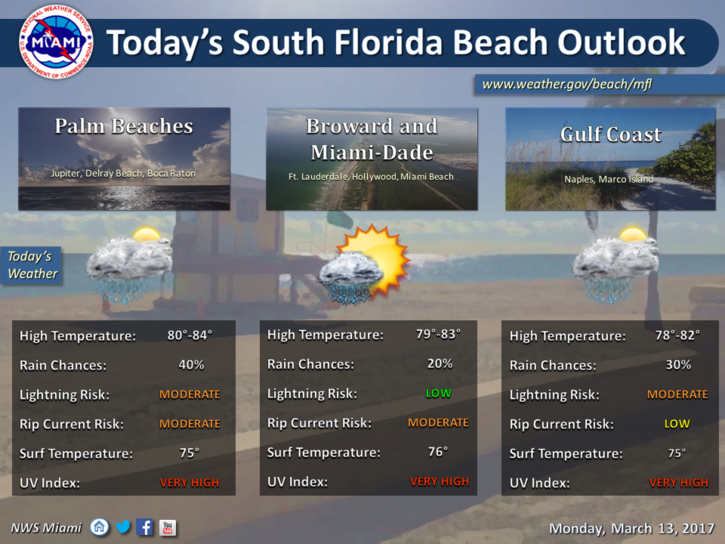
 Showers, storms coming to South Florida late on Monday, followed by much cooler weather. After early fog Monday morning, much of the day features a mix of sun and clouds, along with a moderate risk of dangerous rip currents at the Atlantic beaches. Highs on Monday will be in the low 80s. Then showers and storms will move in late Monday afternoon and evening, with gusty winds and heavy rain at times as a strong front moves in.
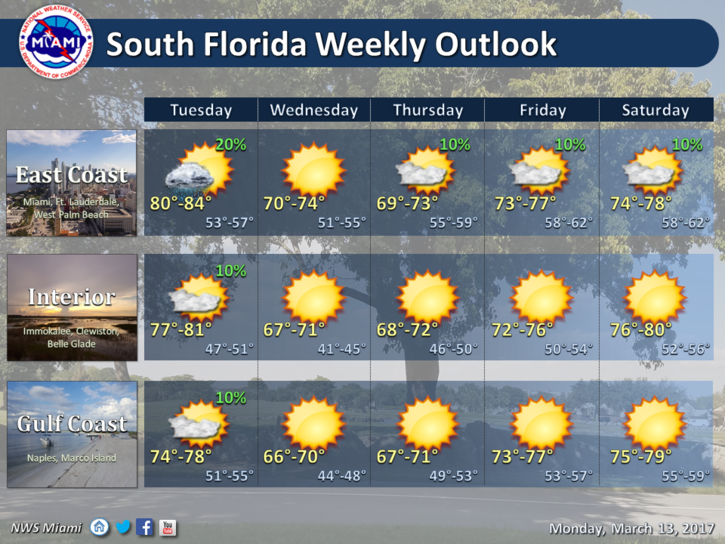 The front will clear the area on Tuesday morning, but a shower or two could linger. Clouds will give way to more sun, and highs will reach the low 80s.
Then cooler air seeps in overnight, and Wednesday morning will bring lows in the mid to upper 50s. The day will feature lots of sun and a few clouds. But Wednesday’s highs will only reach the mid 70s.
Thursday morning will be chilly, with lows in the 50s. Even with lots of sun, highs on Thursday will top out in the mid 70s.
Look for good sun and a few clouds on Friday’s St. Patrick’s Day celebrations. Friday’s highs will be in the mid to upper 70s.


")


