


 South Florida will see mostly east coast showers and a few storms on Thursday. The day features periods of sun, some clouds, a few early east coast showers, and the chance of a storm or two in the east coast metro area. A high risk of dangerous rip currents remains in place at the Atlantic beaches. Highs on Thursday will be near 80 degrees.
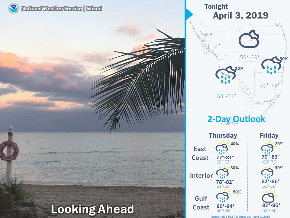
Friday will bring a mix of sun and clouds. Friday’s highs will be in the low 80s.
Look for mostly sunny skies on Saturday. Saturday’s highs will be mostly in the mid 80s.
Some showers and clouds will be back on Sunday, but we’ll also see periods of sun. A quick storm is possible in the east coast metro area. Sunday’s highs will be in the mid 80s.
Monday will feature a mix of sun, clouds, and passing showers and storms. Highs on Monday will be in the mid 80s.


